Great Gable

Going through Little Hell Gate on Great Gable, Lake District – April

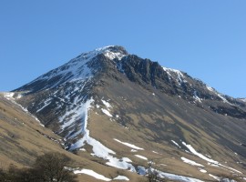
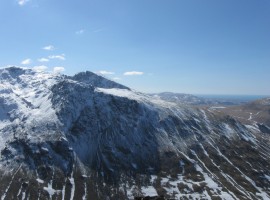
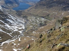
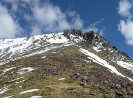
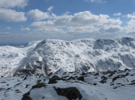
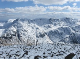
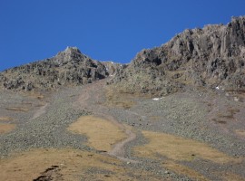
We thought we may have been up Great Gable on a previous occasion (I checked later, and it turned out that we had gone up it in 2009). In any case, we knew that we had not gone up ‘direct’ route up the south-west ridge, through the charmingly named Little Hell Gate.

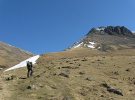
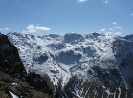
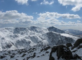
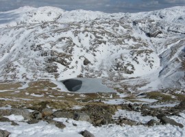
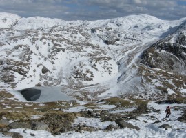
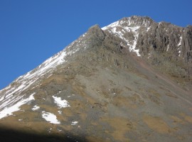
I forgot to look out for Moses’s Finger, from around which we probably should have started going rightwards (eastwards). I might have got quite preoccupied with picking my way up the mixture of scree and rocks on the steep slope. B eventually persuaded me to join him a bit further over to the right, where we discussed the way ahead, and we decided to head back down for the best way across. We came to a climbers’ traverse path, which we followed until we reached the edge of the Little Hell Gate scree. I stuck to the edge as we made our way up to the top, as the scree was very loose and the gradient very steep.

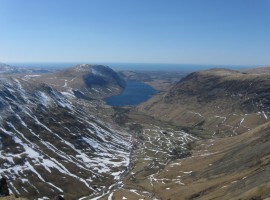
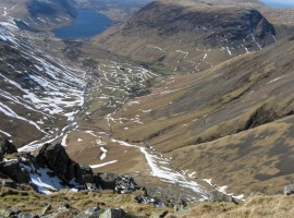
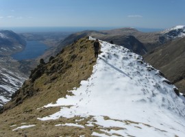
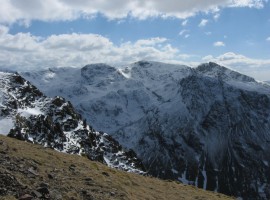
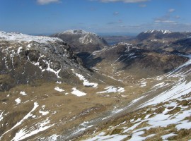
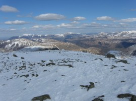
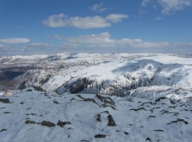
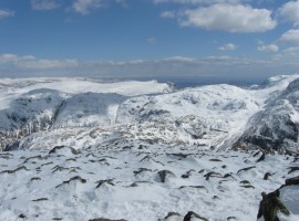
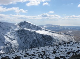
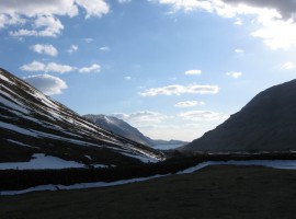
There was some snow at the top, though not as much as over Mickledore and Sca Fell the previous day, so put on our crampons. After some food we made our way down the south-east side of Great Gable to the Sty Head pass junction. Without our crampons again by this point, we took the good diagonal path which took us the most direct way back down to Wasdale Head.

Wasdale Head village green

Wasdale Head village green

Approaching Great Gable

Approaching Great Gable

Great Gable

Great Gable

Starting up the south-west ridge

Starting up the south-west ridge

Looking up south-east towards Sty Head and Great End

Looking up south-east towards Sty Head and Great End

A bt further up the ridge

A bt further up the ridge

Great End and Broad Crag

Great End and Broad Crag

B ahead of me

B ahead of me

Looking back south-west to Wastwater and the sea

Looking back south-west to Wastwater and the sea

Great End, Broad Crag, and Scafell Pike

Great End, Broad Crag, and Scafell Pike (from left to right). As things turned out, the following day we walked over Scafell Pike and continued as far as Great End, and the day after that, we walked over Scafell Pike again, but ended up on the Corridor Route which starts from below the col between Scafell Pike and Broad Crag near the right of the image, and takes a diagonal line down to the left of the image towards Sty Head. The whole thing looks quite steep in this photo!

Scafell Pike and Sca Fell

Scafell Pike and Sca Fell. The crags of Lingmell are in shadow in front.

The village of Wasdale Head, Wastwater, and Yewbarrow to its right

The village of Wasdale Head, Wastwater, and Yewbarrow to its right

Same components, plus a sheep

Same components, plus a sheep

The top of the steep bit of the ridge

Getting to the top of the steep bit of the ridge

Great End, Broad Crag, Scafell Pike, and Sca Fell

Great End, Broad Crag, Scafell Pike, and Sca Fell

Looking north-west towards Kirk Fell and the hills around Buttermere

Looking north-west towards Kirk Fell and the hills around Buttermere – High Stile and High Crag, Hay Stacks, and Fleetwith Pike further behind on the right.

Just a short pull up to the top of Great Gable

Just a short pull up to the top of Great Gable

Extensive views to the north-north-east

Extensive views to the north-north-east

Looking east-north-east towards the Borrowdale Fells

Looking east-north-east towards the Borrowdale Fells, including Glaramara near the right side of the image.

Looking east

Looking east. You can see Glaramara on the left, the Langdale Pikes in the distance in the centre, and the snowy slope on the right leads up towards the major path junction of Esk Hause.

Great End, Ill Crag, Broad Crag, and Scafell Pike

Great End (with Esk Pike behind?), Ill Crag, Broad Crag, and Scafell Pike.

Ill Crag, Broad Crag, Scafell Pike and Sca Fell

Ill Crag, Broad Crag, Scafell Pike and Sca Fell, with Lingmell in front of Sca Fell.

Piers Gill, Lingmell, and Sca Fell

Piers Gill, Lingmell, and Sca Fell. Piers Gill can be seen on the left with a sharp bend, Lingmell is in front with the snowy slope above, and Sca Fell is behind with the col of Mickledore to its left. The top of Sca Fell is in the sun, with Symonds Knott in shadow at the crag edge.

Sca Fell with Symonds Knott in the middle

Sca Fell with Symonds Knott in the middle

Great End, Ill Crag, Broad Crag, and Scafell Pike

Great End, Ill Crag, Broad Crag, and Scafell Pike again, from a slightly different angle. You can see Piers Gill on the right, and the Corridor Route cuts across the centre of the image from the top of Piers Gill downwards to the left.

Styhead Tarn

Styhead Tarn near Sty Head path junction, with Glaramara top left

Going down towards Sty Head path junction

Going down towards Sty Head path junction. It must be Allen Crags near the top right.

Looking back up at Little Hell Gate to the left of the Great Napes

Looking back up at Little Hell Gate to the left of the Great Napes on our way back down to Wasdale Head.

Little Hell Gate scree

A closer view of the Little Hell Gate scree between the White Napes and Great Napes.

The White Napes sticking up to the left of Little Hell Gate

The White Napes sticking up to the left of Little Hell Gate

Wasdale Head and Wastwater

Wasdale Head and Wastwater. The lower slopes of Lingmell on the left, Illgill Head to the left of Wastwater, and Yewbarrow on the right.

Walking behind sheep

Walking behind sheep

Flowers by stile

Flowers by stile in Wasdale Head

Wasdale Head village greenApproaching Great GableGreat GableStarting up the south-west ridgeLooking up south-east towards Sty Head and Great EndA bt further up the ridgeGreat End and Broad CragB ahead of meLooking back south-west to Wastwater and the seaGreat End, Broad Crag, and Scafell PikeScafell Pike and Sca FellThe village of Wasdale Head, Wastwater, and Yewbarrow to its rightSame components, plus a sheepThe top of the steep bit of the ridgeGreat End, Broad Crag, Scafell Pike, and Sca FellLooking north-west towards Kirk Fell and the hills around ButtermereJust a short pull up to the top of Great GableExtensive views to the north-north-eastLooking east-north-east towards the Borrowdale FellsLooking eastGreat End, Ill Crag, Broad Crag, and Scafell PikeIll Crag, Broad Crag, Scafell Pike and Sca FellPiers Gill, Lingmell, and Sca FellSca Fell with Symonds Knott in the middleGreat End, Ill Crag, Broad Crag, and Scafell PikeStyhead TarnGoing down towards Sty Head path junctionLooking back up at Little Hell Gate to the left of the Great NapesLittle Hell Gate screeThe White Napes sticking up to the left of Little Hell GateWasdale Head and WastwaterWalking behind sheepFlowers by stile


View Great Gable via Little Hell Gate – Apr 2013 in a larger map