Cairn Toul now in shadow

A very mixed weather day on the Linn of Dee circuit, Cairngorms, Scotland – September

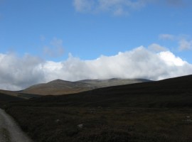
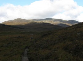
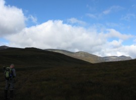
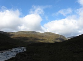
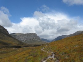
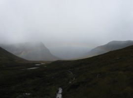
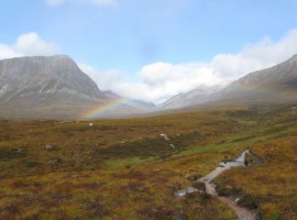
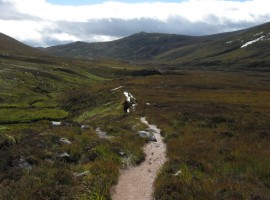
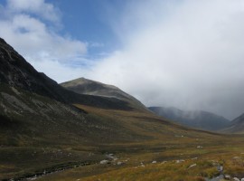
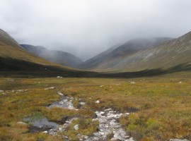
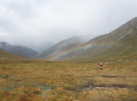
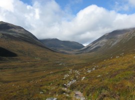
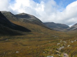
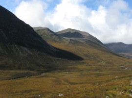
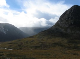
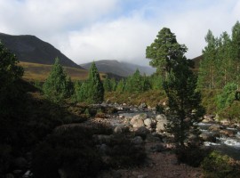
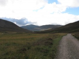
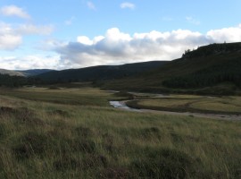
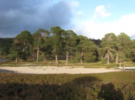
The weather kept changing from sunny to rainy and back again on this 16-mile, 8-hour walk along glens that took us north up Glen Dee, which meets the Lairig Ghru at the Pools of Dee, from the southern end.

We started walking from the Linn of Dee car park, and early on, we came across an elderly man carrying a very large and heavy-looking backpack with a stick (sticks?) walking on his own. We ended up having a short conversation with him, and it seemed he was on a long-distance walk to a destination quite a long way away.

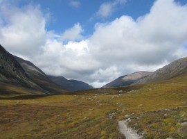
Further up Glen Dee, we passed a young couple doing the circuit in the other direction. The girl asked if it was very muddy the way we had come. She sounded like she was not looking forward to trudging through much more mud.

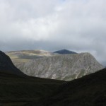
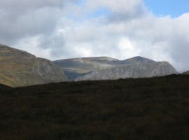
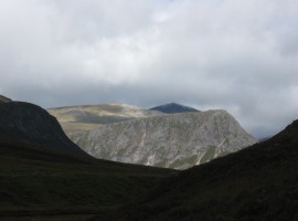
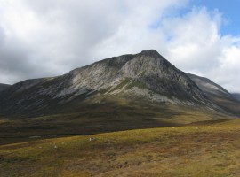
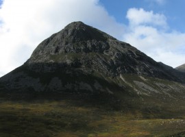
We had a look inside the Corrour bothy, where two young men were staying. It looked quite snug (small) inside. One of them was about to try heading up a nearby slope with camera and tripod to get to the top of the Devil’s Point (Bod an Deamhain or Penis of the Demon), which stands just to the south-west of the bothy and is at the southern end of the group of peaks of (from the north) Braeriach, Carn na Criche, The Angel’s Peak, Cairn Toul, and Stob Coire an t-Saighdeir.

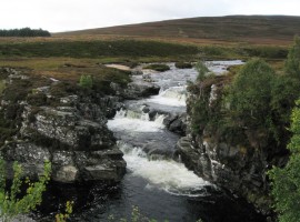
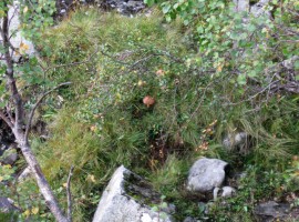
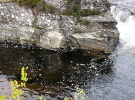
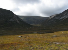
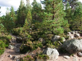
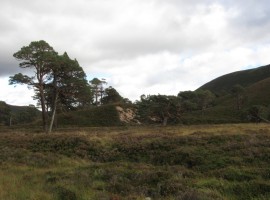
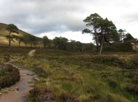
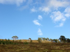
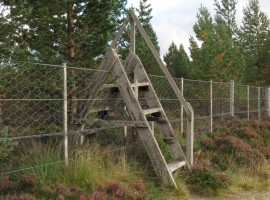
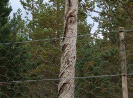
After returning the same way for a short distance back down Glen Dee, we contoured around the foot of Carn a’ Mhaim to head east along Allt Preas nam Meirleach into Gleann Laoigh Bheag. We passed some young men with big backpacks (from somewhere in continental Western Europe, but not sure which country they were from), who were probably planning to stay in Corrour bothy. We imagined it was going to be quite cosy for them. The first exclosure for trees that we came to seemed to have lost its fences, perhaps because the trees had grown enough not to need their protection any longer. The weather continued to change from bright to rainy/overcast. We also passed the abandoned-looking buildings of Derry Lodge. Two young men who joined the track from Luibeg Burn hurried on, then disappeared – it seemed they had wanted to be first to get to the Bob Scott Memorial Hut which we could see on the map. They need not have worried, as we were continuing into Glen Lui until we got back to the Linn of Dee. We took our time, ambling along and taking photographs. I saw some more ptarmigan (or grouse?) droppings. Almost at our destination, we went up to the edge of Lui Water to see what a salmon ladder looks like, as it was marked on the map.

Approaching the hills

Approaching the hills

The Chest of Dee

The Chest of Dee

Mushrooms by the River Dee

Mushrooms by the River Dee. I like the air bubbles in the water too.

Looking into the water

Looking into the water. You could see to the bottom of the river bed.

The path curves gently right to head northwards

The path curves gently right to head northwards

Light and shade

Light and shade

The Devil's Point, Cairn Toul, and Stob Coire an t-Saighdeir

From the right, The Devil’s Point, Cairn Toul behind, and Stob Coire an t-Saighdeir.

Cairn Toul now in shadow

Cairn Toul now in shadow. You can now see that it is behind the other tops.

The River Dee

The River Dee

Looking up Glen Dee

Looking up Glen Dee. With the steep-sided Devil’s Point.

Rain over Glen Dee, with the compensation of a rainbow

Rain over Glen Dee, with the compensation of a rainbow. We saw a lot of rainbows on this trip.

Starting to clear, for now

Starting to clear, for now

The Devil's Point/Bod an Deamhain

The Devil’s Point/Bod an Deamhain. Only the English translation appears on the OS map. It seems Queen Victoria was spared the more literal translation of ‘the demon’s penis’.

Looking north up Glen Dee

Looking north up Glen Dee

Looking north up Glen Dee

Looking north up Glen Dee, towards the Lairig Ghru

Looking back south down Glen Dee

Looking back south down Glen Dee

The Devil's Point with the flank of Cairn Toul behind

The Devil’s Point with the flank of Cairn Toul behind to the right

The lower parts of Braeriach further away

The lower parts of Braeriach further away, with Ben Macdui and Carn a’ Mhaim on the right

Looking left (west) into Glen Geusachan

Looking left (west) into Glen Geusachan. On the left is Beinn Bhrotain, on the right the Devil’s Point, and straight ahead is Monadh Mòr. Geusachan Burn flows out of it to join the River Dee just to the left of the photographed area

Looking up at the Devil's Point

Looking up at the Devil’s Point

More rain coming in

More rain coming in. Cairn Toul is in patchy sunlight, with Braeriach (and Sròn na Lairige) now enshrouded in moisture. Corrour bothy can be seen on the small grassy patch near the floor of the glen.

Light, shade, and moisture

Light, shade, and moisture. Corrour bothy now in shadow.

Marching on

Marching on, approaching Corrour bothy which is on the left of the image.

... and it's cleared again

… and it’s cleared again. It always seems to take longer than you think it’s going to in order to get to where you want to be.

Stob Coire an t-Saghdeir and Cairn Toul

Stob Coire an t-Saghdeir can now be seen between the Devil’s Point and Cairn Toul on the left.

The top of Braeriach is still in the clouds

The top of Braeriach is still in the clouds.

Looking south-west over to Beinn Bhrotain and Monadh Mòr

Looking south-west over to Beinn Bhrotain and Monadh Mòr

Many showers later ...

Many showers later … we reached the first exclosure (or in this case, ex-exclosure) of trees at at the junction of Allt Preas nam Meirleach and Luibeg Burn in Gleann Laoigh Bheag (Glen Luibeg?). A pleasant spot to stop for a snack.

Trees in ex-exclosure

Trees in ex-exclosure. There were rolled-up sections of fencing lying around nearby.

Going down Glen Luibeg towards Luibeg

Going down Glen Luibeg towards Luibeg. There were many tall but some leaning and some gnarled trees.

A wider path through Glen Luibeg

A wider section of path through Glen Luibeg

Leaning trees

Leaning trees

Intertwined trees

Intertwined trees

More hugging trees

More hugging trees

Large trees

Large trees, some leaning, though I wonder if the image might be leaning just a bit too.

Looking back up Glen Luibeg towards Carn a' Mhaim and Beinn Bhrotain

Looking back west up Glen Luibeg towards Carn a’ Mhaim and Beinn Bhrotain

Now in Glen Lui?

Now in Glen Lui?

Blue sky

Blue sky. And another exclosure.

A high stile

A high stile over the high fence of another exclosure.

Light and dark

Light and dark. Shame about the photographer’s shadow.

A tree with twisted bark

A tree with very twisted bark. It looks almost like there is a face looking left.

Approaching the hillsThe Chest of DeeMushrooms by the River DeeLooking into the waterThe path curves gently right to head northwardsLight and shadeThe Devil's Point, Cairn Toul, and Stob Coire an t-SaighdeirCairn Toul now in shadowThe River DeeLooking up Glen DeeRain over Glen Dee, with the compensation of a rainbowStarting to clear, for nowThe Devil's Point/Bod an DeamhainLooking north up Glen DeeLooking north up Glen DeeLooking back south down Glen DeeThe Devil's Point with the flank of Cairn Toul behindThe lower parts of Braeriach further awayLooking left (west) into Glen GeusachanLooking up at the Devil's PointMore rain coming inLight, shade, and moistureMarching on... and it's cleared againStob Coire an t-Saghdeir and Cairn ToulThe top of Braeriach is still in the cloudsLooking south-west over to Beinn Bhrotain and Monadh MòrMany showers later ...Trees in ex-exclosureGoing down Glen Luibeg towards LuibegA wider path through Glen LuibegLeaning treesIntertwined treesMore hugging treesLarge treesLooking back up Glen Luibeg towards Carn a' Mhaim and Beinn BhrotainNow in Glen Lui?Blue skyA high stileLight and darkA tree with twisted bark


Map showing walk route and peaks seen

View Linn of Dee circuit – Sept 2012 in a larger map