The weather forecast was not brilliant, so we set out in the morning with the modest objective of reaching the top of Sàil Liath, the first top of a round of An Teallach done clockwise. We did not take our rope and gear.

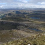
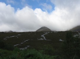
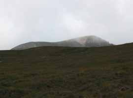
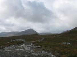
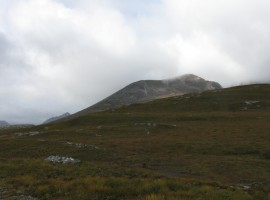
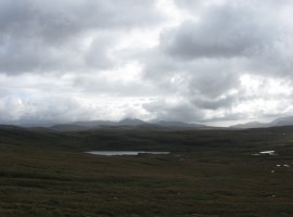
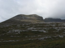
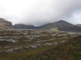
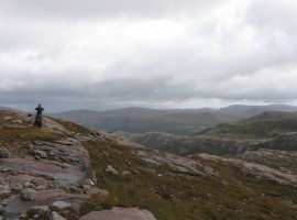
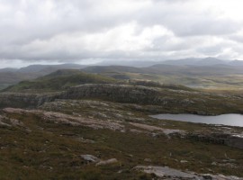
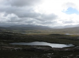
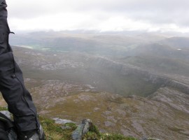
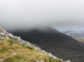
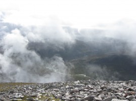
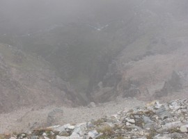
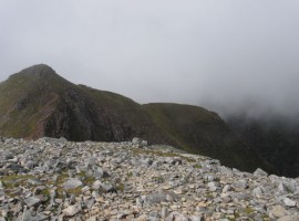
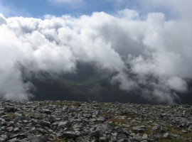
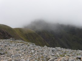
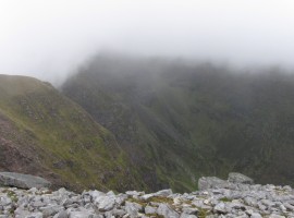
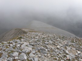
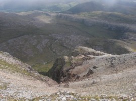
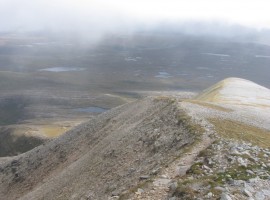
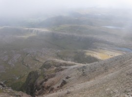
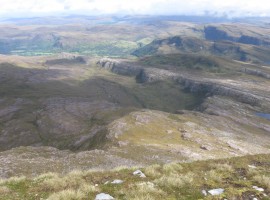
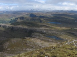
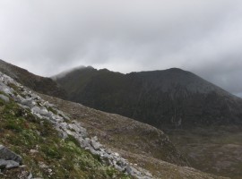
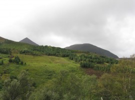
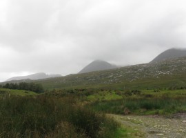
The walk-in up Glen Chaorachain from Corrie Hallie felt quite long, I think particularly because you cannot see the hills that you are aiming for very well as you go. Eventually we reached a major cairn where the path split. We started on the smaller, right-hand path to Shenavall, then came off the path to take a line that skirted around Lochan na Brathan and get us to the foot of Sàil Liath after negotiating stepped rocks. The gradient from there was steep, and being pelted with hail as we went did not help make it pleasant. We reached the shoulder before too long, the platform giving us a great view in between the clouds that kept rolling in.

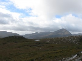
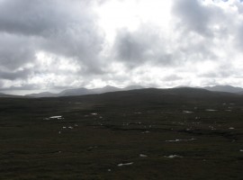
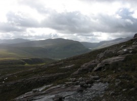
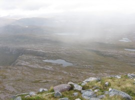
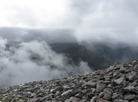
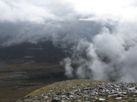
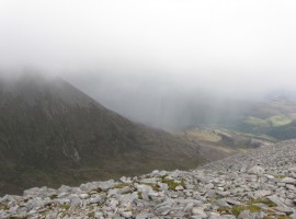
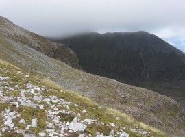
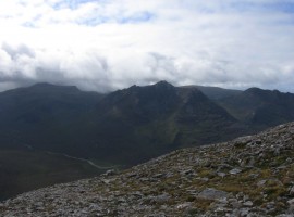
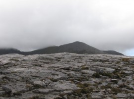
All this while, we still had not been able to get a proper look at the rest of An Teallach. Once we got to the summit of Sàil Liath, we waited for a while to see if the mist might clear, but gave up in the end, deciding to head back down the same way. We did get rained on on the way back as well. We did start going further towards Shenavall just to have a look, but had been put off going too far by the miserable weather and headed back out.

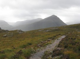
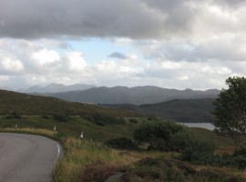
The day had served as a recce of the first part of a round of An Teallach from the east, and we had been able to get a look at the entrance to the so-called Great Wilderness, with thoughts of making a trip over to Shenavall and its famous bothy at some point.

The whole of the following day was a complete washout, with blustery winds thrown in. We gave up hope of the weather improving in the west of Scotland. It looked like the situation might be marginally better in the east, so we decided to change tack completely the day after and head over to the Cairngorms.

Top of An Teallach, with Glas Mheall Liath in the middle

Glimpse of the tops of the peaks of An Teallach

Top of Sail Liath

Top bit of Sail Liath becoming visible

Path to Shenavall

Path to Shenavall. The most prominent peak in the middle of the image is Beinn a’ Chlaidheimh. We got a better look of Beinn Dearg Mor, which is peeking out over on the right, from Sail Liath later

Sail Liath

Sail Liath

Loch an Sail Leithe

A little lochan, Loch an Sail Leithe, with Beinn a’ Chlaidheimh beyond

Dundonnell Forest with many pools of water

Looking across the Dundonnell Forest – not one with trees, but with deer. You can easily see just how many pools of water there are because of the light reflecting in them.

Loch in Dundonnell Forest

Loch Coire Chaorachain, the largest of the many pools of water in the Dundonnell Forest.

Sail Liath from below

Looking up from the lower slopes of Sail Liath

Bidein a' Ghlas Thuill and Glas Mheall Liath

Looking further right to Bidein a’ Ghlas Thuill and Glas Mheall Liath, which are also part of An Teallach. Bidein a’ Ghlas Thuill is the highest point.

View towards Dundonnell

Looking back out towards Dundonnell from one of the rocky shelves

Lochan na Brathan

On the right is Lochan na Brathan, around the edge of which we had come.

Lochan na Brathan

The whole of Lochan na Brathan, with Dundonnell Forest beyond.

Creag Rainich and Loch an Nid

Creag Rainich and Loch an Nid up the valley of Abhainn Loch an Nid

Little fungi

Some strange fungus-like things

Looking down from Sail Liath

Looking down from Sail Liath. The nearest lochan is Lochan na Brathan that we skirted around earlier.

Looking down from Sail Liath

Looking down from Sail Liath

Clouds coming in

Clouds coming in

Bye bye view

Bye bye view

Hail on ground

Bits of hail left on the ground after we got pelted. I was glad I had brought my gloves, as my hands got very cold as soon as they got wet.

Glas Mheall Liath obscured

Glas Mheall Liath obscured

Abhainn Loch an Nid through the clouds

The river Abhainn Loch an Nid visible through the clouds. (Abhainn means river)

Looking down a big cleft

Looking down a big cleft on the north-eastern side of Sail Liath – I would not want to fall down there. Still misty at this point.

Stob Cadha Gobhlach

Stob Cadha Gobhlach was the only top that became properly visible while we were on Sail Liath. It would be the next top on a round of An Teallach, but we decided to head back as originally planned, as it looked like there was more bad weather to come, and we did not want to be doing any serious scrambling in those conditions.

More glimpses

More glimpses

Misty Corrag Bhuidhe

A misty Corrag Bhuidhe beyond Stob Cadha Gobhlach. The pinnacles of Corrag Bhuidhe are known to offer some exposed scrambling. Even to skirt around them would be on exposed paths, where a slip could have serious consequences.

Corrag Bhuidhe

A bit more seen of the flank of Corrag Bhuidhe

Rain over Glas Mheall Liath

Rain over Glas Mheall Liath

South-eastern end of Sail Liath

Looking at the south-eastern end of Sail Liath

A clearer view from Sail Liath

A clearer view from Sail Liath

Flank of Sail Liath

Flank of Sail Liath

Misty again

Misty again

View east from Sail Liath

View east from Sail Liath

View east from Sail Liath

View east from Sail Liath

Glas Mheall Liath

The top of Glas Mheall Liath just becoming visible again

Beinn Dearg Mor

The impressive-looking Beinn Dearg Mor, somewhat crown-shaped.

More of Glas Mheall Liath

More of Glas Mheall Liath

Looking back up as we went back down

Looking back up as we went back down. Still frustratingly little visibility.

Beinn a' Chaidheimh again

Beinn a’ Chaidheimh again. You can see the rain has come in again.

Beinn nam Ban and Beinn Mhor na Coigich

Beinn nam Ban in the middle distance, and further away, Beinn Mhor na Coigich in Coigach

Glas Mheall Liath and Glas Mheall Mor

The pointy top of Glas Mheall Liath, with Glas Mheall Mor to the right. Still could not see properly, this time with another hill in the way.

Sail Liath, Stob Cadha Gobhlach, Glas Mheall Liath, and Glas Mheall Mor

(From left) Sail Liath, Stob Cadha Gobhlach, Glas Mheall Liath, and Glas Mheall Mor

View from the road heading southwards

After disappointing weather of continuous heavy rain and strong winds all of the next day, we finally gave up on the prospect of the weather improving enough to attempt An Teallach. This was a view from the road as we headed southwards again.

Tops of Slioch

We could see the tops of Slioch in the Torridon area as we drove southwards. The weather forecast for the east seemed marginally better than for the west, so we had decided to take a chance and were heading towards the Cairngorms.

Top of An Teallach, with Glas Mheall Liath in the middleTop of Sail LiathPath to ShenavallSail LiathLoch an Sail LeitheDundonnell Forest with many pools of waterLoch in Dundonnell ForestSail Liath from belowBidein a' Ghlas Thuill and Glas Mheall LiathView towards DundonnellLochan na BrathanLochan na BrathanCreag Rainich and Loch an NidLittle fungiLooking down from Sail LiathLooking down from Sail LiathClouds coming inBye bye viewHail on groundGlas Mheall Liath obscuredAbhainn Loch an Nid through the cloudsLooking down a big cleftStob Cadha GobhlachMore glimpsesMisty Corrag BhuidheCorrag BhuidheRain over Glas Mheall LiathSouth-eastern end of Sail LiathA clearer view from Sail LiathFlank of Sail LiathMisty againView east from Sail LiathView east from Sail LiathGlas Mheall LiathBeinn Dearg MorMore of Glas Mheall LiathLooking back up as we went back downBeinn a' Chaidheimh againBeinn nam Ban and Beinn Mhor na CoigichGlas Mheall Liath and Glas Mheall MorSail Liath, Stob Cadha Gobhlach, Glas Mheall Liath, and Glas Mheall MorView from the road heading southwardsTops of Slioch


Map of walk route and nearby peaks

View Sail Liath – Sept 2012 in a larger map