Cairn Toul and The Angel's Peak with Lochan Uaine

Through the Chalamain Gap to Braeriach, Cairngorms, Scotland – September

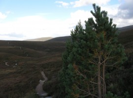
Winds of 20-25 mph with gusts up to 55 mph were forecast. We drove up to the Sugar Bowl car park and were walking soon after 9.30am. It started to rain soon after we started, but we had already put on our waterproof gear in anticipation. We played the passing and re-passing game with two other groups of people all the way up to Braeriach, though as we went on they were ahead as I am still slow at going uphill.

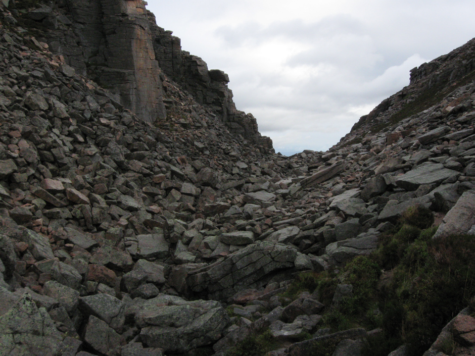
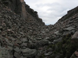
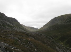
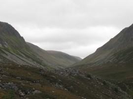
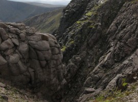
It took 15 minutes to clamber through the short stretch of the Chalamain Gap which is filled with a jumble of large rocks. Recently (in February 2013 – I am writing this in April), there was a report of an avalanche affecting two groups of people who were in the Gap at the time, with three people losing their lives. One of the groups was on a training course from the highly renowned Glenmore Lodge outdoor training centre nearby. It did make me think how careful you need to be, as I remembered that the sides of the Gap are not that high, and not having seen the place in snow, had never imagined that an avalanche could happen there.

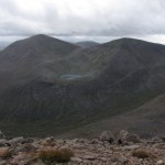
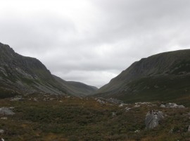
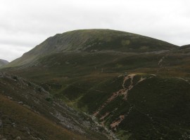
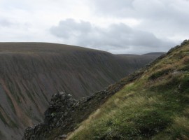
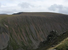
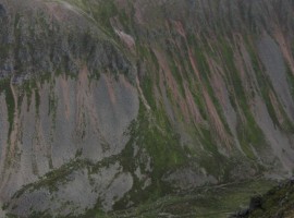
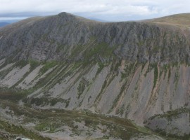
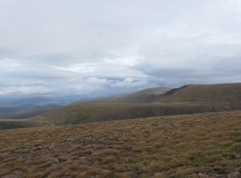
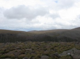
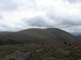
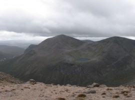
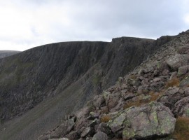
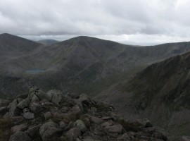
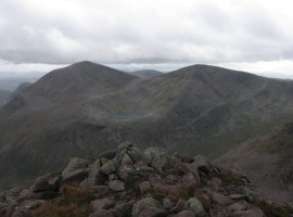
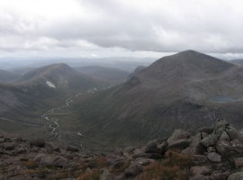
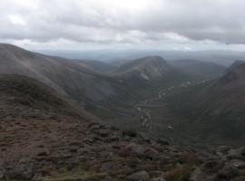
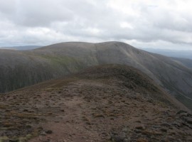
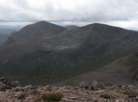
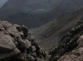
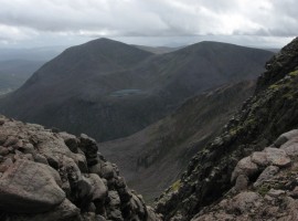
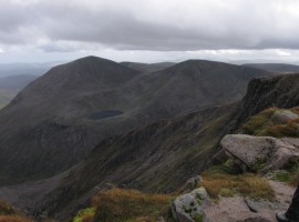
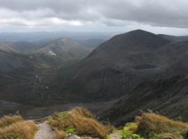
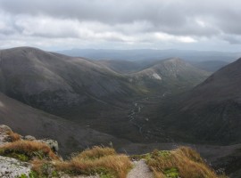
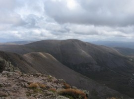
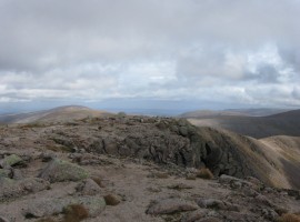
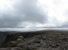
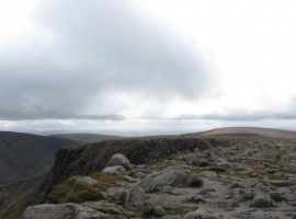
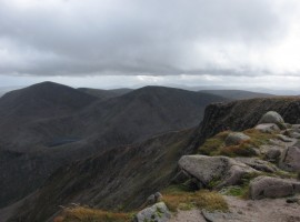
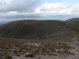
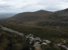
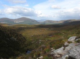
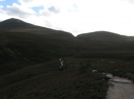
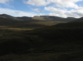
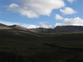
A little while after the Chalamain Gap, we crossed over the Lairig Ghru, which is a long pass that runs into the middle of the overall Cairngorm plateau from the north end, to meet Glen Dee which continues south. From there it felt like a bit of a slog up to the top of Braeriach, though some of the views on the way were great. It was a bit windy. The views from the top were fantastic, though the dark clouds that began to hover above our heads were a bit worrying, looking like they were about to descend on us at any moment. So we beat a hasty retreat. The other two groups had started back down already. Going back was quite a bit faster than getting to the top (4 hours to top, 10 minutes at top, 3 hours back). We passed one of the groups again on the way down, and as we neared the car park, we saw two or three reindeer being led out of a paddock and over a footbridge across Allt Mor, probably being taken to the Reindeer Centre down the hill.

The Chalamain Gap

Looking back at the rock-filled Chalamain Gap, which we had to pick our way through carefully to get over the big jumbled rocks

Approaching the Lairig Ghru pass

Approaching the Lairig Ghru pass which runs through the middle of the Cairngorms

Looking down into the northern end of the Lairig Ghru

Looking down to the right into the northern end of the Lairig Ghru

The other side of the Lairig Ghru

The western side of the Lairig Ghru. The flattish top is the site where the Sinclair Memorial Hut once stood. Beyond that you can see the path up to the shoulder to start the slow pull up Sròn na Lairige.

A closer view up into the Lairig Ghru

A closer view up into the Lairig Ghru, looking south

Ptarmigan droppings

Ptarmigan droppings

View from Sròn na Lairige into the Lairig Ghru

View from Sròn na Lairige into the Lairig Ghru

Cairn Lochan over the Lairig Ghru pass

Cairn Lochan over the Lairig Ghru pass

Stob Coire an t-Snaechda, Cairn Lochan, and the steep side of Lurcher's Crag

Stob Coire an t-Snaechda, Cairn Lochan, and the steep side of Lurcher’s Crag with the floor of the Lairig Ghru pass where the path can be seen

Creag an Leth-choin/Lurcher's Crag over the Lairig Ghru

The pointed peak of Creag an Leth-choin/Lurcher’s Crag over the Lairig Ghru

Cairn Gorm, Stob Coire an t-Snaechda, Cairn Lochan, and Miadan Creag an Leth-choin, with Lurcher's Crag in front

Cairn Gorm, Stob Coire an t-Snaechda, Cairn Lochan, and Miadan Creag an Leth-choin, with Creag an Leth-choin/Lurcher’s Crag in front.

Beinn Mheadhoin visible in the distance above March Burn

Beinn Mheadhoin visible in the distance above March Burn. Looking east from Sròn na Lairige

Ben Macdui

Ben Macdui, where we were the previous day

Cairn Toul and the Angel's Peak over Lochan Uaine

Cairn Toul and Sgòr an Lochain Uaine/the Angel’s Peak over Lochan Uaine. The stream on the right is Allt a’ Gharbh-choire, which flows into the River Dee visible to the left. The Devil’s Point is peeking out from the side of Cairn Toul on the left, and Stob Coire an t-Saghdeir between the two taller peaks. A bit further down Glen Dee, below the Devil’s Point, is the Corrour bothy, where we ended up looking around two days later when we walked up Glen Dee from the other side of the Cairngorm plateau.

Braeriach

Braeriach – the third highest mountain in the British Isles after Ben Nevis and Ben Macdui. When I first saw its top as we were going up to Ben Macdui on the previous day, I had not realised what I was looking at, but now that I have seen it from across the Lairig Ghru and on the summit itself (though not from the other sides), I think I would recognise the subtle lines of this mountain with many corries.

The Angel's Peak with Lochan Uaine

The Angel’s Peak with Lochan Uaine cradled in Coire an Lochain Uaine below. You can see the upper reaches of the stream Allt a’ Gharbh-choire, which is not far down from the Wells of Dee, where the River Dee springs. Three days later we would see the big, rushing waters of the River Dee at the Linn of Dee (see the later post on this). On some other occasion I would like to go that bit further over to Carn na Criche (or come up from another direction) to visit the Wells of Dee.

Cairn Toul and The Angel's Peak with Lochan Uaine

Cairn Toul and Sgòr an Lochain Uaine/The Angel’s Peak with Lochan Uaine

Carn a' Mhaim, the River Dee, and Cairn Toul

Carn a’ Mhaim, the River Dee, and Cairn Toul. Lochan Uaine (the green lochan) can be seen on the right. Just by the dark stone on the left you can see where Allt a’ Gharbh-choire and Allt na Lairig Ghru meet to flow on south as the River Dee.

The sloping line down from Ben Macdui to Carn a' Mhaim

The sloping line down from Ben Macdui to Carn a’ Mhaim

Ben Macdui

Ben Macdui seen from one end of the curved edge of Braeriach. The stream that draws a line between the twin tops of Ben Macdui (the left one is 1295m and the right 1309m high) is called Allt a’ Choire Mhòir

Cairn Toul and The Angel's Peak with Lochan Uaine

Cairn Toul and Sgòr an Lochain Uaine/The Angel’s Peak with Lochan Uaine. It might look as though you would be able easily to walk up the middle from left to right, but what you do not see is that you would come up against a steep-walled corrie barring your way. There is a very basic bothy/shelter called Garbh Choire bothy by that stream almost directly below the lochan, which does not seem to be visible on this photo.

Gully on Braeriach

Gully on Braeriach (not sure if it was East Gully or Central Buttress Gully or another one entirely – there seem to be a lot of them there). The prominence on the right looks like one big disintegrating cairn.

View from gully to Lochan Uaine

View from gully to Lochan Uaine

View from gully to Lochan Uaine

View from gully to Lochan Uaine. Between the two peaks, and closer to the left, you can see the top of Stob Coire an t-Saighdeir on its cliff edge

Lochan Uaine

Lochan Uaine. One minute the water looks paler than the hills that surround it, and the next minute it looks darker.

Carn a' Mhaim, Cairn Toul, and Lochan Uaine

Carn a’ Mhaim, Cairn Toul, and Lochan Uaine. The River Dee winds its way down Glen Dee.

Ben Macdui, Carn a' Mhaim, and Glen Dee

Ben Macdui, Carn a’ Mhaim, and Glen Dee. The wide part is where the Lairig Ghru meets Glen Dee. You can see tha path running from the left to the right.

Ben Macdui across the Lairig Ghru/Glen Dee

Ben Macdui across the Lairig Ghru/Glen Dee

The top of the East Gully on Braeriach

Looking at the top of the East Gully (?) on Braeriach

View from the top of Braeriach

View from the top of Braeriach over to the top of Carn na Criche, with the dark gash of the top of West Gully in front. Another time, when we are not in a hurry to get back down again, it would be good to go a bit further (perhaps come up from another direction) and look at the Wells of Dee, where the River Dee first emerges, eventually for the water to flow into the North Sea at Aberdeen.

Cairn Toul, the Angel's Peak, and Braeriach

Cairn Toul, the Angel’s Peak, and Braeriach. Two more tops can be seen behind the Angel’s Peak – on the left, Beinn Bhrotain, and on the right, Monadh Mòr (probably).

The way back over Sròn na Lairige

The way back over Sròn na Lairige

Creag a' Chalamain

The hill of Creag a’ Chalamain can be seen, with the path that leads back to the Chalamian Gap. It’s not just downhill from here!

Emerging from the Chalamain Gap

Emerging from the Chalamain Gap. The highest of the hills in the middle distance must be Meall a’ Bhuachaille

Brown cup fungus on path

Slightly squished-looking brown cup fungus on path. Ascomycetes

Whitened wood in peaty soil

Whitened wood in peaty soil

Whitened wood in peaty soil

Whitened wood in peaty soil

The path back to the car park

The path back to the car park. It’s a good path.

Whitened wood

Whitened wood

Looking back at the Chalamain Gap

Looking back at the Chalamain Gap

Stob Coire an t-Snaechda, Cairn Lochan, and Miadan Creag an Leth-choin

Stob Coire an t-Snaechda, Cairn Lochan, and Miadan Creag an Leth-choin

The crags of Stob Coire an t-Snaechda between the Fiacaills

The crags of Stob Coire an t-Snaechda between Fiacaill a’ Choire Chais and Fiacaill Coire an t-Snaechda

Puffball mushrooms

Common puffball mushrooms

The Chalamain GapApproaching the Lairig Ghru passLooking down into the northern end of the Lairig GhruThe other side of the Lairig GhruA closer view up into the Lairig GhruPtarmigan droppingsView from Sròn na Lairige into the Lairig GhruCairn Lochan over the Lairig Ghru passStob Coire an t-Snaechda, Cairn Lochan, and the steep side of Lurcher's CragCreag an Leth-choin/Lurcher's Crag over the Lairig GhruCairn Gorm, Stob Coire an t-Snaechda, Cairn Lochan, and Miadan Creag an Leth-choin, with Lurcher's Crag in frontBeinn Mheadhoin visible in the distance above March BurnBen MacduiCairn Toul and the Angel's Peak over Lochan UaineBraeriachThe Angel's Peak with Lochan UaineCairn Toul and The Angel's Peak with Lochan UaineCarn a' Mhaim, the River Dee, and Cairn ToulThe sloping line down from Ben Macdui to Carn a' MhaimBen MacduiCairn Toul and The Angel's Peak with Lochan UaineGully on BraeriachView from gully to Lochan UaineView from gully to Lochan UaineLochan UaineCarn a' Mhaim, Cairn Toul, and Lochan UaineBen Macdui, Carn a' Mhaim, and Glen DeeBen Macdui across the Lairig Ghru/Glen DeeThe top of the East Gully on BraeriachView from the top of BraeriachView from the top of BraeriachCairn Toul, the Angel's Peak, and BraeriachThe way back over Sròn na LairigeCreag a' ChalamainEmerging from the Chalamain GapBrown cup fungus on pathWhitened wood in peaty soilWhitened wood in peaty soilThe path back to the car parkWhitened woodLooking back at the Chalamain GapStob Coire an t-Snaechda, Cairn Lochan, and Miadan Creag an Leth-choinThe crags of Stob Coire an t-Snaechda between the FiacaillsPuffball mushrooms


Map showing walk route and other peaks seen

View Braeriach – Sept 2013 in a larger map