The Lord's Rake

Finding a way up to Sca Fell, Lake District – April

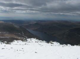
We had been up to Scafell Pike before (in 2006): it is the highest mountain in England at 978m, and there is a relatively easy way up to the top. On the last occasion, it was in December, and there was a bit of snow at the top. I had felt a bit nervous about stepping into the snow, but had not had any mishaps, and had been rewarded with my first Brocken spectre.

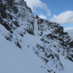
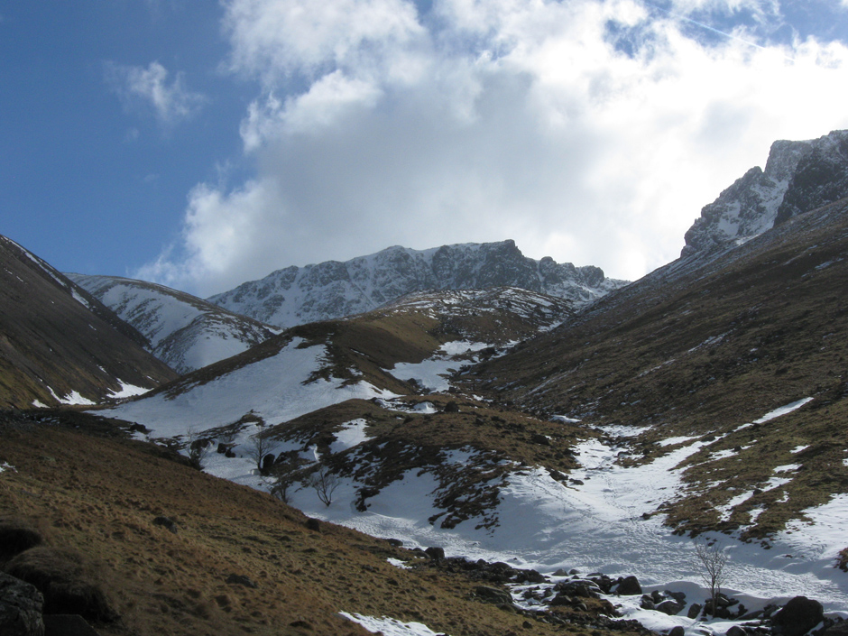
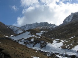
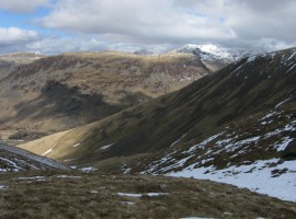
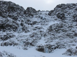
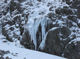
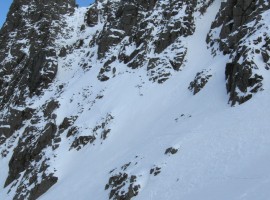
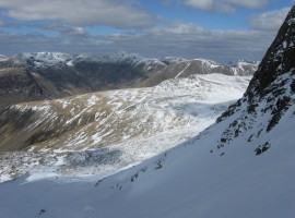
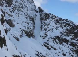
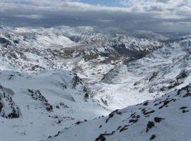
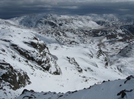
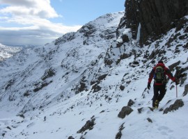
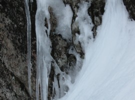
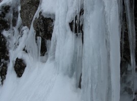
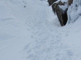
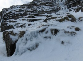
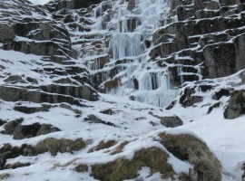
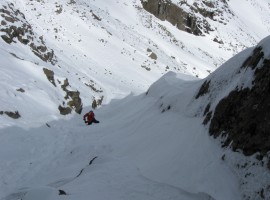
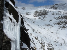
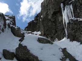
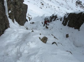
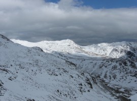
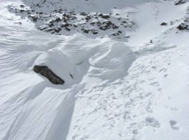
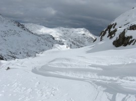
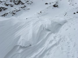
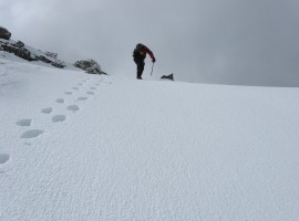
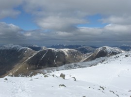
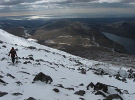
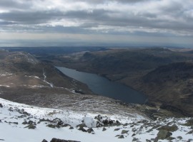
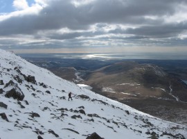
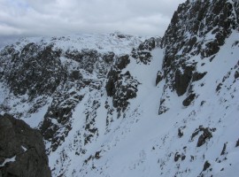
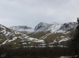
This time, we decided to try and get up to Sca Fell, which is just on the other side of the col of Mickeldore, but not as frequented as its neighbour due to the relative difficulty of accessing its summit. When we started walking into snow on Brown Tongue up Lingmell Gill, we decided that it was time to put on our crampons and get our ice axes out. We kept to the right as we went up Hollow Stones in order to have a look for the Lord’s Rake, which we were interested in trying as a scrambling route up to Sca Fell. On the way up, we saw several iced-over waterfalls looking like sculptures. There was a fair amount of snow in the Rake. I wanted to go up further to have a closer look, but did not trust the lying snow on the slopes going up to the bottom of the rake, so we ended up turning away more towards the centre of the way up to Mickledore. The snow was already disturbed where people had gone up and down, and with ice axe and crampons it felt quite easy to get up to the col.

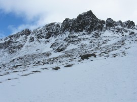
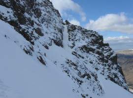
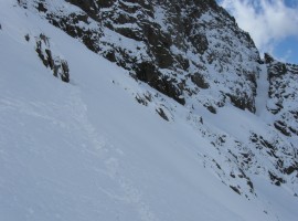
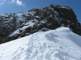
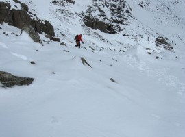
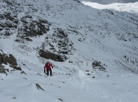
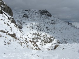
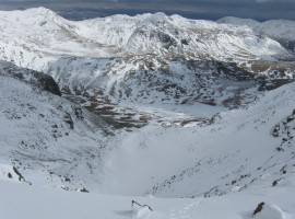
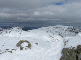
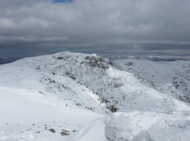
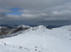
Not being rock climbers, we were not going to go up directly to Sca Fell via the Broad Stand route, so we decided to have a look at the way down the other side of the col for the gully up to Foxes Tarn. This felt fine, so we continued up from Foxes Tarn, going up quite steeply, but with care, until we reached the shoulder of Sca Fell. It was a short walk from there up to the summit.

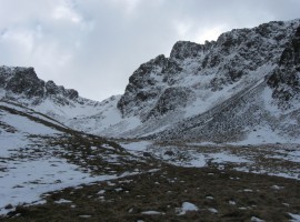
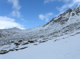
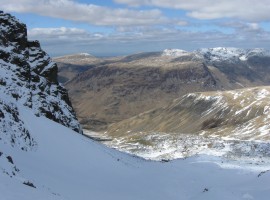
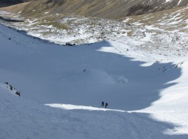
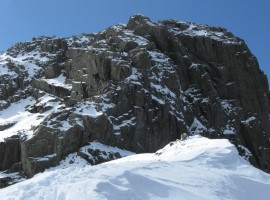
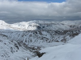
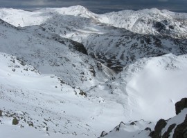
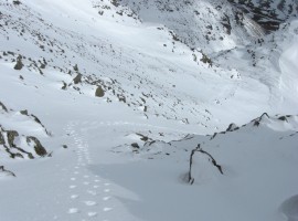
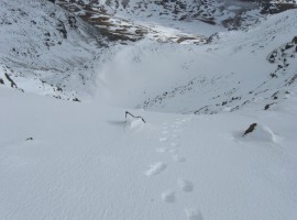
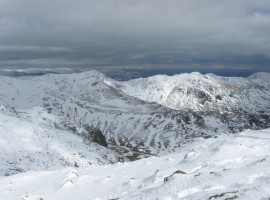
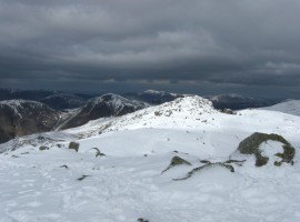
We walked over to Symonds Knott, which is on the edge of the crags over Mickledore, and followed the Scafell Crag edge closely downwards from there. We were trying to find the top of the Lord’s Rake, and came across more than one gully. (I later looked into this further, and found that the lower gully we had stood by was the top of the Lord’s Rake, which is climbed in three sections, with two ‘cols’.) We would our way down gradually over Green How, then turned more sharply downhill to the side of a stream. B persuaded me to try sliding down the snow covering the stream bed as a quicker way down. The snow quite soft, which meant it was quite hard to brake using my ice axe, and as the layer was not that thick, the axe bumped over rocks in some places. I have to admit that it took a lot less time to get down to the valley floor than picking my way carefully down the steep slope. From there it was just a short walk back to the campsite. Very convenient.

Looking up towards Scafell Pike over Brown Tongue

Looking up towards Scafell Pike over Brown Tongue

In the Hollow Stones area

In the Hollow Stones area

Looking back down over Lingmell Gill to the lower slopes of Lingmell, Yewbarrow, and Red Pike

Looking back down over Lingmell Gill to the lower slopes of Lingmell, Yewbarrow, and Red Pike

Frozen waterfalls

Frozen waterfalls down the crags

Pulpit Rock on the Scafell Pike side of Mickedore

Pulpit Rock on the Scafell Pike side of Mickedore

The gentler way up to Scafell Pike

The gentler way up to Scafell Pike, where we had gone the last time we were in this area.

One of the impressive icy waterfalls

One of the impressive icy waterfalls

The Lord's Rake

The Lord’s Rake, filled with snow.

The main way up to Mickledore

The main way up to Mickledore

Looking back down to Hollow Stones

Looking back down to Hollow Stones. You can see two people standing by the big boulder down there.

A good view across to Mosedale

A good view across to Mosedale and its surrounding tops, such as Red Pike and Pillar. Great Gable can be seen above the whitish Lingmell.

We went across as far as the rock on the left

We went across as far as the rock on the left and came back again to continue upwards.

A closer view of the Lord's Rake

A closer view of the Lord’s Rake

People coming up from Hollow Stones

People coming up from Hollow Stones

The view south-east over the other side of Mickledore

The view south-east over the other side of Mickledore

Looking towards the Broad Stand climbing route

Looking towards the Broad Stand climbing route made famous by Coleridge

Wondering where the exact line of the climb is located

Wondering where the exact line of the climb is located. It’s actually a bit further to the left (included in previous photo)!

Stunning view down into Great Moss

Stunning view down into Great Moss over the other side of Mickledore

Finding a way down to the gully for Foxes Tarn

Finding a way down to the gully for Foxes Tarn

More ice art

More ice art

Icicles

Icicles

The gully up to Foxes Tarn

The gully up to Foxes Tarn

Stepped frozen waterfall

Stepped frozen waterfall to the right of the gully.

Frozen waterfall

Frozen waterfall

B coming up the gully

B coming up the gully

Looking back over towards Mickledore

Looking back over towards Mickledore (should be around the corner to the left)

Looking further up the gully

Looking further up the gully

Looking down the gully

Looking down the gully

Emerging from the gully

Emerging from the gully

Sunlit slope in the distance

Sunlit slope in the distance

A sunlit Bow Fell

A sunlit Bow Fell in the middle, with Crinkle Crags further to the right. Esk Pike to the left of Bow Fell?

Looking across Great Moss to Crinkle Crags

Looking across Great Moss to Crinkle Crags

Natural snow art

Natural snow art

Looking over to Scafell Pike

Looking over to Scafell Pike

Looking towards Bow Fell

Looking towards Bow Fell. I think the camera was quite tilted here.

More snow art

More snow art

Another fantastic view

Another fantastic view, looking back down the way we had come

Looking back down at our footprints

Looking back down at our footprints

The final pull up to the col before the summit

The final pull up to the col before the summit

The view keeps changing

The view keeps changing

This is where we just came up

This is where we just came up

Burnmoor Tarn, with Illgill Head to its right

Burnmoor Tarn, with Illgill Head to its right

Wastwater to the right of Illgill Head

Wastwater to the right of Illgill Head

The top of Scafell Pike in the distance

The top of Scafell Pike in the distance. Symonds Knott is close by, over on the left.

Scafell Pike and the hills beyond

Scafell Pike and the hills beyond

Bow Fell and Crinkle Crags again

Bow Fell and Crinkle Crags again

The closest tops (from left) are Pillar, Kirk Fell, and Great Gable

The closest tops (from left) are Pillar, Kirk Fell, and Great Gable

Symonds Knott

Symonds Knott

Symonds Knott in bright sunlight

Symonds Knott in bright sunlight

Snow art on rock

Snow art on rock

Looking down a gully on Scafell Crags

Looking across Deep Gill gully near Symonds Knott on Sca Fell. You can see someone’s footprints in the narrow band of snow on the other side.

Descending towards Green How

Descending towards Green How

Wastwater

Wastwater

Sunlight on the sea

Sunlight on the sea

Looking at the second 'col' of the Lord's Rake

Looking at the second ‘col’ of the Lord’s Rake. From the other side, you can only see up to the first ‘col’.

View from back at the campsite

View from back at the campsite. Not a bad view!

Looking up towards Scafell Pike over Brown TongueIn the Hollow Stones areaLooking back down over Lingmell Gill to the lower slopes of Lingmell, Yewbarrow, and Red PikeFrozen waterfallsPulpit Rock on the Scafell Pike side of MickedoreThe gentler way up to Scafell PikeOne of the impressive icy waterfallsThe Lord's RakeThe main way up to MickledoreLooking back down to Hollow StonesA good view across to MosedaleWe went across as far as the rock on the leftA closer view of the Lord's RakePeople coming up from Hollow StonesThe view south-east over the other side of MickledoreLooking towards the Broad Stand climbing routeWondering where the exact line of the climb is locatedStunning view down into Great MossFinding a way down to the gully for Foxes TarnMore ice artIciclesThe gully up to Foxes TarnStepped frozen waterfallFrozen waterfallB coming up the gullyLooking back over towards MickledoreLooking further up the gullyLooking down the gullyEmerging from the gullySunlit slope in the distanceA sunlit Bow FellLooking across Great Moss to Crinkle CragsNatural snow artLooking over to Scafell PikeLooking towards Bow FellMore snow artAnother fantastic viewLooking back down at our footprintsThe final pull up to the col before the summitThe view keeps changingThis is where we just came upBurnmoor Tarn, with Illgill Head to its rightWastwater to the right of Illgill HeadThe top of Scafell Pike in the distanceScafell Pike and the hills beyondBow Fell and Crinkle Crags againThe closest tops (from left) are Pillar, Kirk Fell, and Great GableSymonds KnottSymonds Knott in bright sunlightSnow art on rockLooking down a gully on Scafell CragsDescending towards Green HowWastwaterSunlight on the seaLooking at the second 'col' of the Lord's RakeView from back at the campsite


Map of walk route

View Sca Fell via Mickledore and Foxes Tarn – Apr 2013 in a larger map