Going down the Corridor Route

… and again … but taking in another top and a different way down, Lake District – April

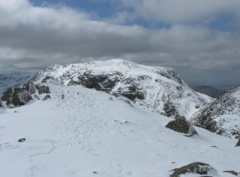
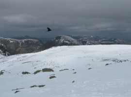
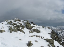
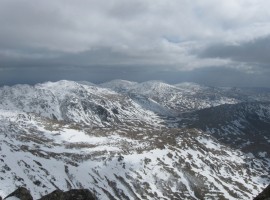
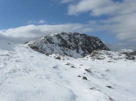
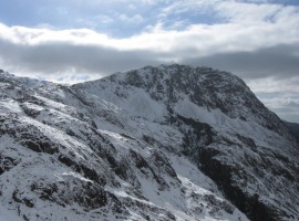
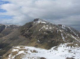
This time, we went up to Scafell Pike by way of Mickledore again, but with the intention of varying the walk from there. Once up to the shoulder of Broad Crag after passing over Scafell Pike, we took the time to do the short walk over to the top of Ill Crag and back. A crow flew down near us and watched us for a few minutes. This happens fairly often, and I always wonder what kind of food it is they are hoping to find.

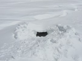
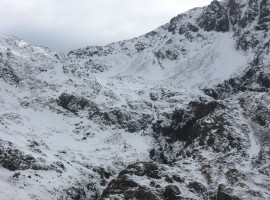
B was interested in taking a proper look at the snowhole we passed the day before, so after descending from the same col, we both crawled in one at a time to have a look. The snow had by this time melted somewhat, so we were mindful of the possibility of the ceiling caving in and burying us under a ton of snow, and only had a brief look. It was quite a large snowhole, with space for about five or six people, with an air hole to one side in the ceiling where the snow had since thinned somewhat.

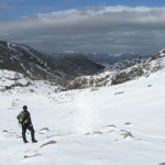
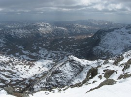
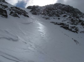
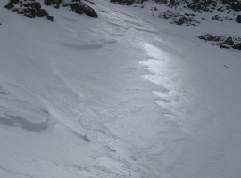
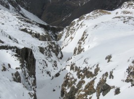
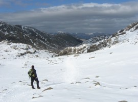
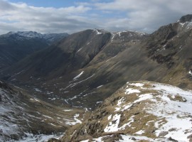
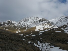
I wanted to have a look at the path following the lip of the deep Piers Gill, so we edged extremely cautiously across the very narrow, snow-covered strip around the rock between the top of the gully part of Piers Gill and the top of the Corridor Route to Sty Head. We started following the gill down, but after a while we reached a section where we did not feel confident about proceeding further, as we were not familiar with the route and could not be sure of the conditions underfoot in the snow. So we retrace our steps until we reached the top of the Corridor Route, and started following the footprints in the snow gradully down towards Sty Head. The going was quite straightforward, with one or two traverses above steep drops, and one easy scramble up a rock wall signposted by an upwards-pointing arrow painted on the rockface.

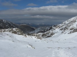
We turned off from the path before the col at Sty Head, finding a way down onto the arcing path down along Lingmell Beck which does not seem that well used, despite it being very pleasant, perhaps because it is a less direct way to and from Sty Head. We kept looking up towards Piers Gill to see if we might have been able to come down all the way without too much difficulty. (Reading about the path later, back at home, I think it might be sensible if we wait until it is clear of snow to attempt it for the first time, maybe going up it rather than coming down it, as there is what sounds like a slightly exposed bit of scrambling, and it seems there is a also bit of a gap that you have to go over at one point.)

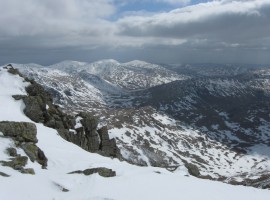
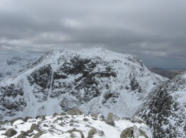
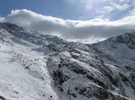
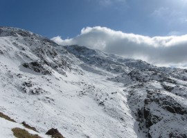
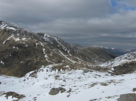
Later, looking at my photos from the day up Great Gable, I was interested to see the line of the Corridor Route across the mountainside in the snow.

Sca Fell

Sca Fell

Looking south-east from Ill Crag

Looking south-east from Ill Crag. There seems a little less snow around than there was three days earlier. In the distance, centre, I think is Dow Crag, with the Old Man of Coniston to its left (just behind Grey Friar?), so I think to the left of that would be Swirl How.

Sca Fell from Ill Crag

Sca Fell from Ill Crag

Crow at Ill Crag

Crow at Ill Crag

Crow at Ill Crag

Crow at Ill Crag

Looking over Great Moss

Looking over Great Moss

Scafell Pike

Scafell Pike

Bow Fell and Crinkle Crags

Bow Fell and Crinkle Crags

Crinkle Crags on the left

Crinkle Crags on the left, and Cold Pike, Little Stand and Ulpha Fell?

Shining snow

Shining snow

Shining snow

Shining snow

Snow hole entrance

Snow hole entrance

Looking down Piers Gill

Looking down snow-filled Piers Gill, with Kirk Fell beyond

Great Gable from the top of the Corridor Route

Great Gable from near the top of the Corridor Route

Looking down the Corridor Route

Looking down the Corridor Route

Looking back up

Looking back up towards Lingmell

Going down the Corridor Route

Going down the Corridor Route. The footprints in the snow are shining with reflected sunlight

Looking back up the Corridor Route

Looking back up the Corridor Route

Line of disturbed snow along the Corridor Route

Line of disturbed snow along the Corridor Route

The great chasm of Piers Gill in front of Lingmell

The great chasm of Piers Gill in front of Lingmell

Red Pike, Kirk Fell, and Great Gable

Looking down Lingmell Beck, with Red Pike beyond Mosedale on the left, Kirk Fell in the middle, and Great Gable on the right. From the Corridor Route, looking out over Stand Crag?

Great Gable from the Corridor Route

Great Gable in the middle and Green Gable on its right, from the Corridor Route

Looking towards Sty Head from the Corridor Route

Looking towards Sty Head from the Corridor Route

Looking up at the area of a route beside Piers Gill

Looking up at the area of a route beside Piers Gill

Looking back up Lingmell Beck

Looking back up Lingmell Beck

The Great Napes on Great Gable

The Great Napes on Great Gable, with the clear opening of Great Hell Gate to its right

Sca FellLooking south-east from Ill CragSca Fell from Ill CragCrow at Ill CragCrow at Ill CragLooking over Great MossScafell PikeBow Fell and Crinkle CragsCrinkle Crags on the leftShining snowShining snowSnow hole entranceLooking down Piers GillGreat Gable from the top of the Corridor RouteLooking down the Corridor RouteLooking back upGoing down the Corridor RouteLooking back up the Corridor RouteLine of disturbed snow along the Corridor RouteThe great chasm of Piers Gill in front of LingmellRed Pike, Kirk Fell, and Great GableGreat Gable from the Corridor RouteLooking towards Sty Head from the Corridor RouteLooking up at the area of a route beside Piers GillLooking back up Lingmell BeckThe Great Napes on Great Gable


Map of walk route

View Scafell Pike, Ill Crag, and the Corridor Route – Apr 2013 in a larger map