(Blog entry below photographs)

The northern end of the Cuillin ridge seen from Sligachan

The northern end of the Cuillin ridge seen from our campsite at Sligachan. Sgurr nan Gillean is on the left, Sgurr a’ Bhasteir on the right; Am Basteir in the middle is hidden in cloud, the Bhasteir Tooth is just visible to its right above the right-hand snow patch.

The Black Cuillin ridge

The Black Cuillin looking … black? Well, brooding, at least.

A closer view of the ridge

A closer view of the ridge, the pointy final peak of the traverse (Sgurr nan Gillean) visible towards the right

A slightly sunnier view of the Cuillin range

A slightly sunnier view of the Cuillin range

Approaching Loch Coruisk by boat

Approaching Loch Coruisk, which is on the other side of the low mounds near the foreground. The peaks of Sgurr a’ Ghreadaidh, Sgurr a’ Mhadaidh, and Bruach na Frithe visible behind them.

Seals lying on the shore of Loch Scavaig

Seals lying on the shore of Loch Scavaig. By this time, my camera had stopped focusing properly when zoomed in.

The Dubhs

Sgurr Dubh na Da Bheinn, Sgurr Dubh Mor and Sgurr Dubh Beag – The Dubhs.

Approaching the Dubh slabs

Approaching the slabs forming the lower part of the Dubh Ridge

Looking up the slabs

Looking up the slabs

Looking down at Loch Coruisk

Looking down at Loch Coruisk from a ledge on the slabs

View from further up the slabs

View from further up the slabs

Dubh slabs with the Cuillin ridge beyond

Behind the slanting slabs of the Dubh Ridge are the long line of Druim nan Ramh in the middle distance, emerging from Bidein Druim nan Ramh on the left, and the rest of the northern section of the ridge in the distance – An Caisteal, Bruach na Frithe, Sgurr a’ Fionn Choire, Bhasteir Tooth and Am Basteir, Sgurr nan Gillean and Sgurr Beag.

More of the Dubh Ridge

More of the Dubh Ridge

Looking across Loch Coruisk towards Bla Bheinn

Looking across Loch Coruisk towards Bla Bheinn

Druim nan Ramh ridgeline

The continuation of the Druim nan Ramh side ridge

Looking down to Loch Coruisk

The other half of our group, B1, P, and J on a lower ledge on the Dubh Ridge

Leading the way up

Our guide M leading the way up the ridge

Allt a' Chaoich (Mad Burn) flowing into Loch Scavaig

Allt a’ Chaoich (Mad Burn) flowing into Loch Scavaig, the sea loch just beyond the enclosed Loch Coruisk. The mainland is visible in the distance.

View from further up Dubh Ridge

View from further up the Dubh Ridge

A better view of the northern part of the ridge

A better view of the northern (for us, latter) part of the ridge

Coming down below Sgurr Dubh Beag

Coming down below Sgurr Dubh Beag

After the downclimb

P, B1, and J on a ledge not long after the downclimb

Looking north-west along the ridge

Looking north-west. The Inaccessible Pinnacle (commonly called the In Pinn) poking up a little bit near the top of the sloping Sgurr Dearg.

Sgurr Dubh na Da Bheinn

Sgurr Dubh na Da Bheinn on the right, with the island of Canna near the horizon out at sea

Looking down into Coir' an Lochain from Sgurr Dubh Mor

Looking down into Coir’ an Lochain from Sgurr Dubh Mor. The Coruisk River flows down the larger lower corrie of Coir’ Uisg, with the complex tops of Bidein Druim nan Ramh above the upper stream.

Coir' a' Ghrunnda

A peek south-west from Sgurr Dubh na Da Bheinn down into Coir’ a’ Ghrunnda. The islands are Canna on the right, Rum on the left, with Soay being the closer one on the left.

View from the bivvy cave

View south-east from the bivvy cave. Visible are Sgurr Dubh na Da Bheinn (which we’d come over), Sgurr nan Eag, Sgurr a’ Choire Bhig, and Gars-bheinn (the southern end of the ridge). Loch Coir’ a’ Ghrunnda below.

Drama on the ridge

A flurry of activity on the ridge, with a helicopter winching down a couple of mountain rescue team personnel. 7.50 pm

Looking out of the cave

Looking out of the cave. 8.50 pm

The heli now flying overhead

The helicopter now flying overhead, still looking for the injured person reported to be in the area. (The group was later found in a different location to what was initially reported.) 8.55 pm

Soay and Rum

The islands of Soay and Rum

Loch Coir' a' Ghrunnda in the evening light

Loch Coir’ a’ Ghrunnda in its corrie in the evening light, with Sgurr nan Eag behind it (visited 5 days later)

View towards the Dubhs

View towards the Dubhs. 9.00 pm

Looking up at Sgurr Alasdair

Looking up at Sgurr Alasdair, our first peak of the second day.

The northern end of the Cuillin ridge seen from SligachanThe Black Cuillin ridgeA closer view of the ridgeA slightly sunnier view of the Cuillin rangeApproaching Loch Coruisk by boatSeals lying on the shore of Loch ScavaigThe DubhsApproaching the Dubh slabsLooking up the slabsLooking down at Loch CoruiskView from further up the slabsDubh slabs with the Cuillin ridge beyondMore of the Dubh RidgeLooking across Loch Coruisk towards Bla BheinnDruim nan Ramh ridgelineLooking down to Loch CoruiskLeading the way upAllt a' Chaoich (Mad Burn) flowing into Loch ScavaigView from further up Dubh RidgeA better view of the northern part of the ridgeComing down below Sgurr Dubh BeagAfter the downclimbLooking north-west along the ridgeSgurr Dubh na Da BheinnLooking down into Coir' an Lochain from Sgurr Dubh MorCoir' a' GhrunndaView from the bivvy caveDrama on the ridgeLooking out of the caveThe heli now flying overheadSoay and RumLoch Coir' a' Ghrunnda in the evening lightView towards the DubhsLooking up at Sgurr Alasdair

We had been preparing all year for this since our decision to attempt the Black Cuillin traverse on the Isle of Skye. A lot of time and effort had gone into training for it and making arrangements.

Normally we would have driven and camped using B’s van, but as we had only so many days off from work on this occasion, we flew to Scotland for the first time. Arriving at Inverness on Saturday, we drove a small hire van to Skye in persistent rain, with both B and me struggling to stay awake after a poor night’s sleep. B had started feeling unwell just as we were about to get away, so the next day was spent at Sligachan campsite with him trying to rest and recover enough to be able to attempt the Cuillin traverse, while we tried not to feel down at what seemed a possible prospect of the traverse attempt being called off due to a poor weather forecast. P and B1 (number added to differentiate him from B) arrived from Grangemouth to join us on Sunday evening, after which we heard from our lead guide for the traverse, M. We had booked four days of guiding (another first for us, as we usually visit the hills by ourselves) with the ideal scenario being preparing for two days and traversing on days 3 and 4, but as the forecast was best for the first two days, the plan was adjusted accordingly by M. Over days 1 and 2 it was to be!

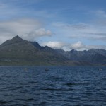
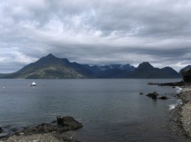
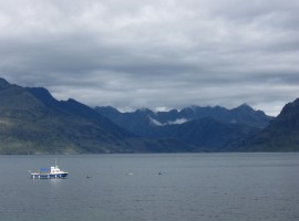
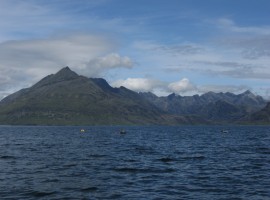
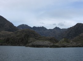
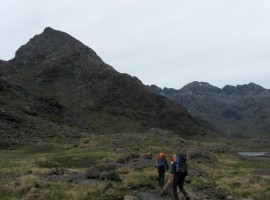
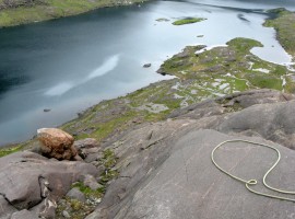
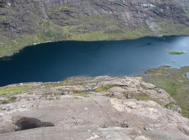
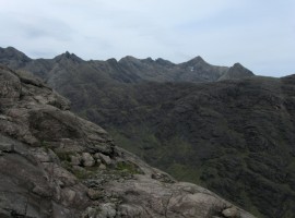
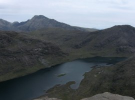
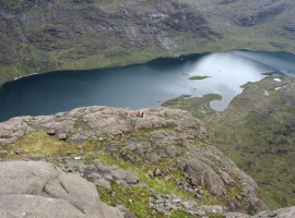
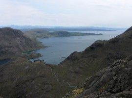
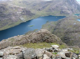
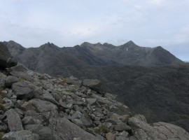
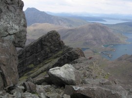
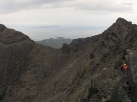
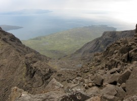
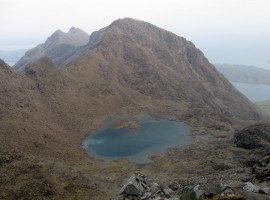
On Monday morning, our guides M and J came to meet us, and we travelled to Elgol, further south on Skye, to take the boat across Loch Scavaig to the edge of Loch Coruisk near the south end of the ridge. We started a bit later in the morning to coincide with the improvement in weather. About noon we set off walking along the shore of Loch Coruisk to the foot of the Dubh Ridge slabs, filling up with water from a stream along the way. M’s plan, as he had not had a chance to see how well we moved on rock, was to get us up this alternative way (a conventional traverse would have started up Gars-bheinn, the southernmost top) to get a lot of scrambling in, after which we would bivvy overnight in a cave near Sgurr Alasdair, and then to stash our bivvy gear for later collection so that we could travel with lighter packs for the longer second day.

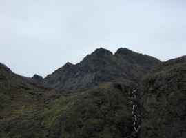
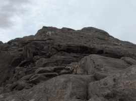
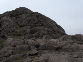
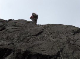
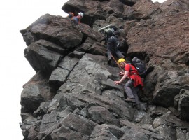
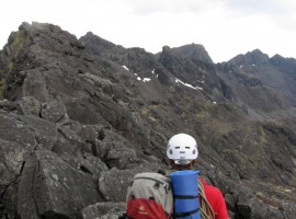
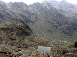
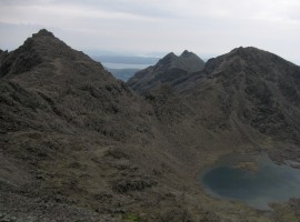
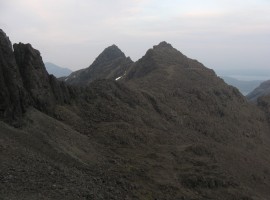
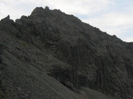
I got a cut on a fingertip on the rough rock very early on after starting up the slabs (and by the end of the two days my fingertips were in a bit of a mess), but the rock was reassuringly dry, and it was a pleasant way of getting some practice going up slabs. There was use of belaying in places, and of moving together roped up in two groups of three. Moving together as a three was something that took a bit of getting used to, especially as the one in the middle! We went over Sgurr Dubh Mor on to Sgurr Dubh na Da Bheinn to join the main ridge. Then we skirted around below Sgurr Alasdair for the time being to reach the somewhat damp cave where we were to spend the night.

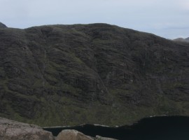
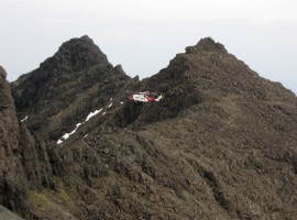
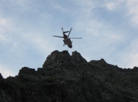
As we started setting up for the night, a rescue helicopter appeared, and eventually winched down a couple of Mountain Rescue personnel who were looking for an injured person reported to be in the area. M went to join them briefly to help with the search. (The injured person was eventually found in a different location to what was initially reported, and was safely taken down.) J went to collect some water from a spring a bit of a way down from where we were. Once we had eaten, we tried to get to sleep, which was a little difficult with water dripping from the cave ceiling onto our faces (and if you cover up your face you can’t breathe very well), though otherwise it was a very calm, warm night. B somehow ended up getting water inside his bivvy bag and sleeping bag, which meant he had a very uncomfortable night! J did not have a great night’s sleep either, as he was just outside the cave, and got showered on a couple of times overnight. I think M said he slept quite well!