Looking back south from Sgurr Mhic Choinnich

^^-áµ¥-^-^ Second day of the Cuillin traverse – Skye, Scotland, May ^áµ¥–^-^

(Blog entry below the photographs)

Blurry view of bivvy cave

A blurry photo of the bivvy cave taken around 4.50 am as we set off

First view of the day from the ridge

First view of the day from the ridge – an inversion. 5.10 am

Looking ahead from Sgurr Alasdair

Looking ahead (north) from Sgurr Alasdair, the highest point in the Cuillin. In the middle distance is Sgurr Mhic Choinnich with Hart’s Ledge/Collie’s Ledge visible as a clear band across its side.

Looking north-east

Looking north-east

Sun emerging above the Red Cuillin

Sun emerging above Marsco in the Red Cuillin

Going up Sgurr Thearlaich

Going up Sgurr Thearlaich after passing the top of the Great Stone Shoot

Admiring the sunrise

Admiring the sunrise

Looking back at Sgurr Alasdair

Looking back at Sgurr Alasdair, our first peak of the day. We passed a couple of bivviers still in their sleeping bags by the top of the Great Stone Shoot.

View south-east towards the Dubhs

View south-east towards the Dubhs which we had come up, with the misty-looking outlier Bla Bheinn behind.

Sgurr Mhic Choinnich ahead

Sgurr Mhic Choinnich ahead, behind which are Sgurr a’ Ghreadaidh, Sgurr a’ Mhadaidh and its three lower tops, and Bidein Druim nan Ramh. Further still are Bruach na Frithe, Am Basteir, and Sgurr nan Gillean.

Sgurr Mhic Choinnich and rest of ridge

A slightly blurred Sgurr Mhic Choinnich, Sgurr Dearg and the In Pinn, Sgurr na Banachdich and Sgurr Thormaid, then as before, Sgurr a’ Ghreadaidh, etc.

A reddened Sgurr Alasdair in the morning light

A reddened Sgurr Alasdair in the early morning light

Preparing to descend from Sgurr Thearlaich

The boys preparing to descend from Sgurr Thearlaich in the morning light

Light effects on a morning inversion

Light effects on a morning inversion

Looking north-east across Druim nan Ramh

Looking north-east across Druim nan Ramh towards Sgurr nan Gillean

Looking back at Sgurr Thearlaich and Sgurr Alasdair

Looking back at Sgurr Thearlaich and Sgurr Alasdair

The In Pinn high above the An Stac screes

The thin fin of the In Pinn clearly visible high above the An Stac screes

The In Pinn on Sgurr Dearg

The In Pinn on Sgurr Dearg, guarded by a rampart of rocks

Looking west down into Coire Lagan

Looking west down into Coire Lagan, from Hart’s Ledge below Sgurr Mhic Choinnich

Traversing Hart's Ledge

Traversing Hart’s Ledge

Up to the summit of Sgurr Mhic Choinnich

Going up to the summit of Sgurr Mhic Choinnich

The In Pinn

The In Pinn again, but a bit closer

Ascending to Sgurr Mhic Choinnich

Ascending to Sgurr Mhic Choinnich from Hart’s Ledge

Sgurr Dearg and the In PInn

Sgurr Dearg and the In PInn

Looking back south from Sgurr Mhic Choinnich

Looking back south from Sgurr Mhic Choinnich at Sgurr Thearlaich and Sgurr Alasdair. Sgurr Sgumain is behind them.

Shadow of ridgeline being cast towards the sea

Shadow of ridgeline being cast towards the sea

Looking up at An Stac

Looking up at An Stac, behind which the In Pinn is now hidden

Silhouette of ridge

Silhouette of Sgurr Mhic Choinnich, Sgurr Thearlaich, Sgurr Alasdair, and Sgurr Sgumain. The Great Stone Shoot screes can be seen falling down below Alasdair.

Walking up to the In PInn

Walking up to the In PInn

Cave-like openings below Sgurr Dearg

Cave-like openings below Sgurr Dearg

Coming up to the In Pinn

Coming up to the bottom of the In Pinn

Looking up at first pitch of In Pinn

Looking up at the first pitch of the In Pinn. No queue as it was still early in the morning!

First pitch of In Pinn

The first section of the East Ridge of the Inaccessible Pinnacle. (Another saved corrupted photo)

Leading up the In Pinn

M leading up the In Pinn

Another view back south-east

Another view back (south-east) from the airy In Pinn with the Dubhs visible behind

Sgurr Dearg with the rest of the ridge beyond

Sgurr Dearg sloping down in front, with the rest of the ridge (still to do) beyond

The sheer drop on the Coruisk side of the In Pinn

The sheer drop on the (east-ish) Coruisk side of the In Pinn

Further up the In Pinn

Further up the narrow fin

By the Bolster Stone at the top of the In Pinn

By the Bolster Stone at the top of the In Pinn, looking down at the crest of Sgurr Dearg on which it casts its shadow

Looking at the north-east end of Sgurr Dearg

Looking at the north-east end of Sgurr Dearg

Great Stone Shoot below Sgurr Alasdair

A clearer image of the Great Stone Shoot below Sgurr Alasdair, extending towards the floor of Coire Lagan.

Abseiling down the west ridge of the In Pinn

M abseiling down the west ridge of the In Pinn after we came down.

Sitting on Sgurr Dearg below the In Pinn

B sitting on Sgurr Dearg below the In Pinn. 9.00 am

Silhouetted at the top of the In Pinn

J silhouetted at the top of the In Pinn, leading B1 and P.

A backlit In Pinn

A backlit In Pinn with Sgurr Thearlaich and Sgurr Alasdair visible in the bottom right corner of the frame

Onwards to Sgurr na Banachdich

Onwards to Sgurr na Banachdich

Sgurr na Banachdich, Sgurr Thormaid, and Sgurr a' Ghreadaidh

Sgurr na Banachdich, Sgurr Thormaid, the Three Teeth, and Sgurr a’ Ghreadaidh

Looking north-east towards Sgurr a' Ghreadaidh

Looking north-east towards Sgurr a’ Ghreadaidh

Looking back south-east towards the Dubhs

Looking back south-east towards the Dubhs, Sgurr Mhic Choinnich, Sgurr Thearlaich, Sgurr Alasdair, and Sgurr Dearg

Looking east down towards Loch Coruisk

Looking east down towards Loch Coruisk. The Dubhs that we came up are visible slanting up to the right from the lochside.

Looking north-east from Sgurr a' Ghreadaidh

Looking north-east from Sgurr a’ Ghreadaidh, through Bidein Druim nan Ramh to Sgurr nan Gillean. Sgurr a’ Mhadaidh and its three lower tops are in the near distance.

Clearer view of ridge ahead

Clearer view of ridge ahead (corrupted image now recovered!)

Looking back up at Sgurr a' Ghreadaidh and the Wart

Looking back up at Sgurr a’ Ghreadaidh and the Wart

View south-east from Eag Dubh

View south-east from Eag Dubh, a cleft in the ridge, towards the now-foreshortened Loch Coruisk with Loch Scavaig beyond it.

From Eag Dubh looking east over Druim nan Ramh

From Eag Dubh looking east over Druim nan Ramh towards Bla Bheinn

Looking back

Looking back

Looking back southwards

Looking back southwards

Ahead from Sgurr a' Mhadaidh towards its three lower tops

Ahead from Sgurr a’ Mhadaidh towards its three lower tops. The final peak of Sgurr nan Gillean in the distance.

Looking back up at Sgurr a' Mhadaidh

Looking back up at Sgurr a’ Mhadaidh

Leading the way up to the 'third top'

M leading the way up to the ‘third top’ (counted from the north)

Looking back at summit of Sgurr a' Mhadaidh

Looking back at summit of Sgurr a’ Mhadaidh

Looking back south-west from Sgurr Bhairnich to An Caisteal

Over two hours later (how time flies … !) Looking back south-west from Sgurr Bhairnich to An Caisteal, with Bidein Druim nan Ramh and the rest beyond.

Descending An Caisteal to the gap

P, B1, and J descending An Caisteal to the gap

Onwards along and up to Bruach na Frithe

Onwards along and up to Bruach na Frithe

East from Bruach na Frithe

East from Bruach na Frithe to the now-closer goal, Sgurr nan Gillean. 4.30 pm. Another inversion on its way.

The Red Cuillin hills peeking over the shoulder of the ridge

The Red Cuillin hills peeking over the shoulder of the ridge on the left

The Red Cuillin peaks half-covered in cloud

The Red Cuillin peaks half-covered in cloud

Looking back along the ridge from Bruach na Frithe

Looking back along the winding ridge from Bruach na Frithe

Walking along the ridge towards Sgurr a' Fionn Choire

Walking (not scrambling!) along the ridge towards Sgurr a’ Fionn Choire. Am Basteir is to the left, with Sgurr nan Gillean appearing between them.

Mist creeping around the Bhasteir Tooth and Am Basteir

Mist creeping around the Bhasteir Tooth and Am Basteir

Sgurr nan Gillean beyond Am Basteir

Looking at Sgurr nan Gillean beyond Am Basteir. The top of the northern Pinnacle Ridge approach to Sgurr nan Gillean is just visible to the left of the summit

A misty Coire a' Bhasteir

At last on the final summit! 6.00 pm. Rewarded with the scene of mist/cloud streaming into Coire a’ Bhasteir. The ‘window’ that we came through on the way up can be seen at the bottom right.

Layers along the ridge

Layers along the ridge

Inversion over Glen Sligachan

Inversion over Glen Sligachan, flowing over the Red Cuillin but leaving Bla Bheinn clear

Wave-like cloud by Bla Bheinn

Wave-like cloud by Bla Bheinn

Misty Coire a' Bhasteir

M silhouetted against a misty Coire a’ Bhasteir. I was just happy to be taking in everything around us for a few minutes. It took another 3 hours to get back down to our campsite.

Blurry view of bivvy caveFirst view of the day from the ridgeLooking ahead from Sgurr AlasdairLooking north-eastSun emerging above the Red CuillinGoing up Sgurr ThearlaichAdmiring the sunriseLooking back at Sgurr AlasdairView south-east towards the DubhsSgurr Mhic Choinnich aheadSgurr Mhic Choinnich and rest of ridgeA reddened Sgurr Alasdair in the morning lightPreparing to descend from Sgurr ThearlaichLight effects on a morning inversionLooking north-east across Druim nan RamhLooking back at Sgurr Thearlaich and Sgurr AlasdairThe In Pinn high above the An Stac screesThe In Pinn on Sgurr DeargLooking west down into Coire LaganTraversing Hart's LedgeUp to the summit of Sgurr Mhic ChoinnichThe In PinnAscending to Sgurr Mhic ChoinnichSgurr Dearg and the In PInnLooking back south from Sgurr Mhic ChoinnichShadow of ridgeline being cast towards the seaLooking up at An StacSilhouette of ridgeWalking up to the In PInnCave-like openings below Sgurr DeargComing up to the In PinnLooking up at first pitch of In PinnFirst pitch of In PinnLeading up the In PinnAnother view back south-eastSgurr Dearg with the rest of the ridge beyondThe sheer drop on the Coruisk side of the In PinnFurther up the In PinnBy the Bolster Stone at the top of the In PinnLooking at the north-east end of Sgurr DeargGreat Stone Shoot below Sgurr AlasdairAbseiling down the west ridge of the In PinnSitting on Sgurr Dearg below the In PinnSilhouetted at the top of the In PinnA backlit In PinnOnwards to Sgurr na BanachdichSgurr na Banachdich, Sgurr Thormaid, and Sgurr a' GhreadaidhLooking north-east towards Sgurr a' GhreadaidhLooking back south-east towards the DubhsLooking east down towards Loch CoruiskLooking north-east from Sgurr a' GhreadaidhClearer view of ridge aheadLooking back up at Sgurr a' Ghreadaidh and the WartView south-east from Eag DubhFrom Eag Dubh looking east over Druim nan RamhLooking backLooking back southwardsAhead from Sgurr a' Mhadaidh towards its three lower topsLooking back up at Sgurr a' MhadaidhLeading the way up to the 'third top'Looking back at summit of Sgurr a' MhadaidhLooking back south-west from Sgurr Bhairnich to An CaistealDescending An Caisteal to the gapOnwards along and up to Bruach na FritheEast from Bruach na FritheThe Red Cuillin hills peeking over the shoulder of the ridgeThe Red Cuillin peaks half-covered in cloudLooking back along the ridge from Bruach na FritheWalking along the ridge towards Sgurr a' Fionn ChoireMist creeping around the Bhasteir Tooth and Am BasteirSgurr nan Gillean beyond Am BasteirA misty Coire a' BhasteirLayers along the ridgeInversion over Glen SligachanWave-like cloud by Bla BheinnMisty Coire a' Bhasteir

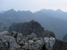
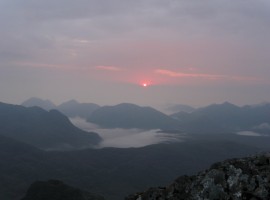
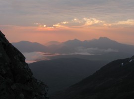
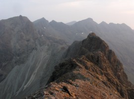
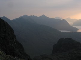
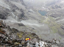
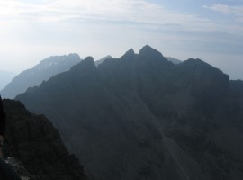
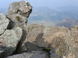
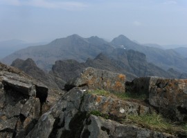
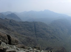
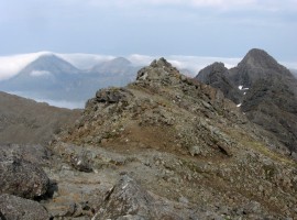
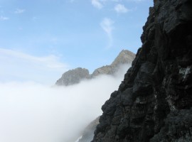
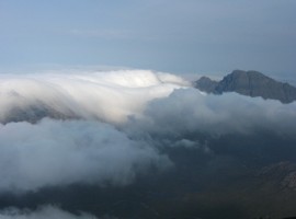
All too soon (or not soon enough?), M’s alarm quietly sounded at 3.00 am, and we started getting up. Eating and drinking what we could, we stashed our sleeping gear near the cave, and set off up to Sgurr Alasdair, the highest point in the Cuillin. Getting onto the ridge shortly after 5.00 am, we enjoyed a lovely sunrise over an inversion. Interestingly, the tiny summit of Alasdair felt roomier than on my previous visit which I think must have been over 10 years ago, when I clung on to the rock in order to take a couple of photos on my 35mm film camera before the film ran out.

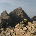
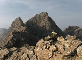
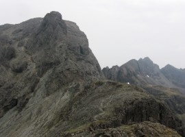
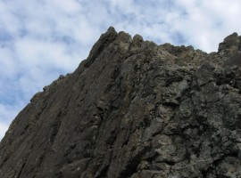
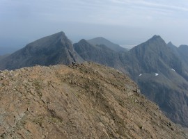
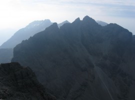
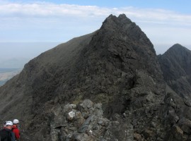
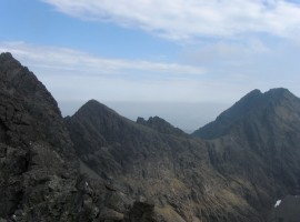
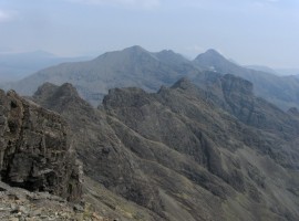
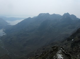
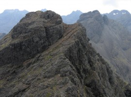
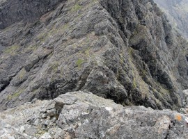
From there, we were on the go for 13 hours to the point when we got to the summit of Sgurr nan Gillean, the last on the traverse, stopping for as little time as possible. To save time, we ended up not doing some of the harder climbing sections, such as the Thearlaich-Dubh Gap, King’s Chimney, and Naismith’s Route on the Basteir Tooth, and also skirted around Am Basteir, one of the Munros on the ridge (we also missed out the Munro Sgurr nan Eag at the south end of the ridge due to the alternative start), but this seemed an acceptable compromise in order to complete the traverse and not have to come down from the ridge before Sgurr nan Gillean for one reason or another. (In fact , it gives us something to go back for at a later date!) The traverse was the main objective.

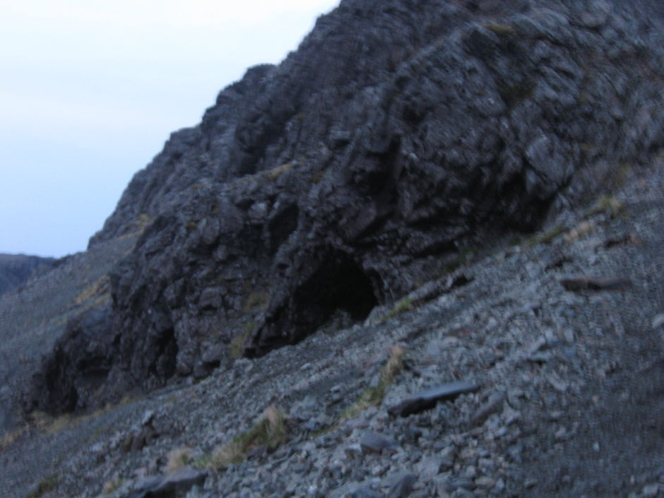
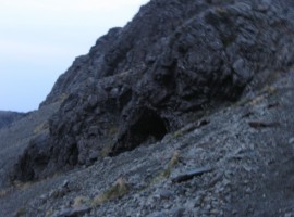
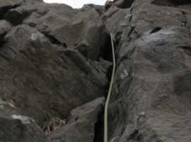
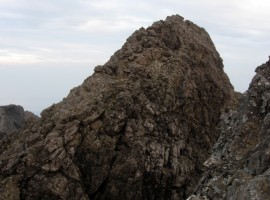
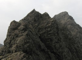
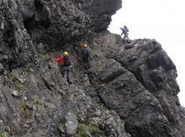
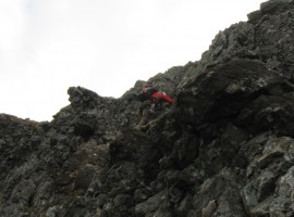
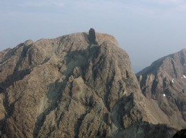
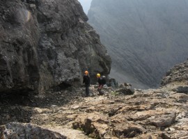
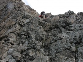
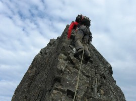
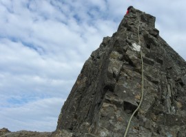
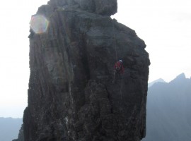
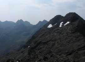
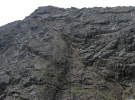
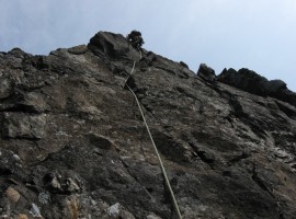
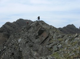
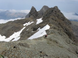
We did get to climb up the In Pinn (Inaccessible Pinnacle, said to be the hardest Munro to summit due to its ascent being a rock climb), which was pleasing, as we had looked at it on our trips to the Cuillin over the years and wondered if we ever would. Surprisingly, I did not feel the exposure on it, though of course I was seconding the climb, following the very capable M who led the route. It was interesting how M being there to take care of protecting the climbs and harder scrambles took away much of the fear in exposed situations, allowing us to concentrate on our technique. He also knew the way very well, which meant that we wasted no time route-finding. He had also efficiently stashed 9 litres of water along the way to keep us going for the day (there is very little water to be found along the ridge).

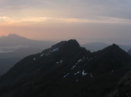
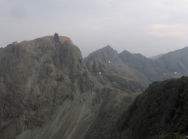
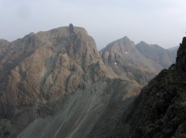
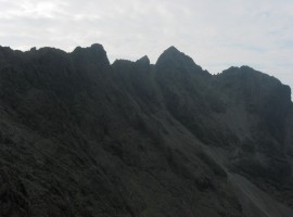
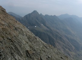
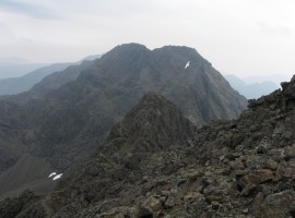
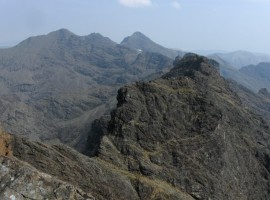
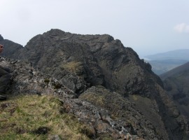
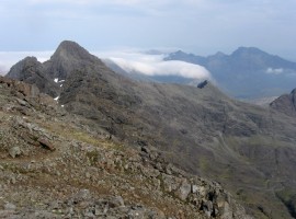
On reaching Sgurr na Banachdich, the next peak after Sgurr Dearg, I found that I had no particular memory of our last visit to this summit quite a number of years ago with A from Edinburgh, whom B and I had walked with after we met him on the ridge on the day. What I do remember is walking out along to the end of Sgurr nan Gobhar and awkwardly descending a narrow person-wide gully to get back to the Glen Brittle road, slightly tearing the seat of my waterproof troursers in the process. The summit of Bruach na Frithe did not feel particularly familiar either, though I suppose we had taken a different way up to it and back the previous time 9 years ago.

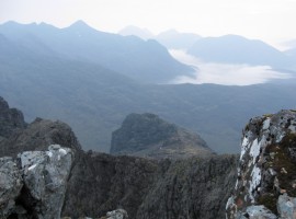
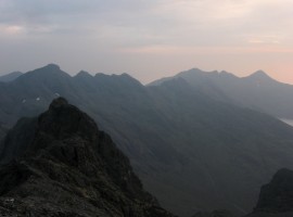
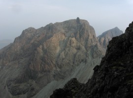
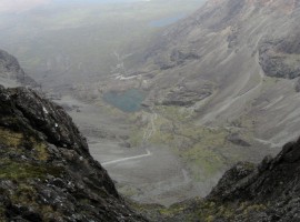
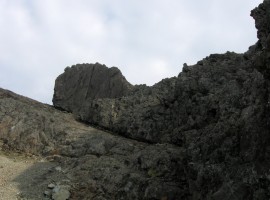
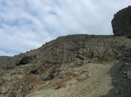
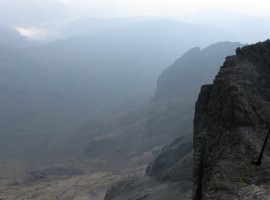
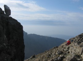
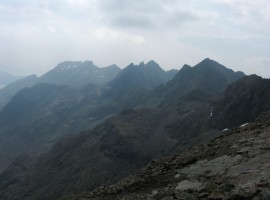
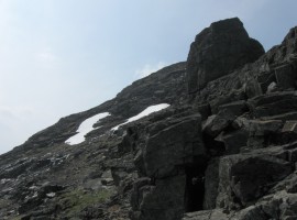
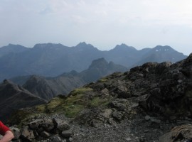
As we had to keep moving as fast as possible, there was not much time to stop and process what we were doing and take in our surroundings, only a few moments here and there to take some quick photographs. While I enjoyed all the scrambling and bits of easy climbing, the second day is a bit of a blur in terms of its details and progression, with photographs serving as the only reminders of certain moments along the way. (This could mean that either we would have to do the traverse again (!), in order to take it in more fully, or maybe return to go over certain sections again to get a better sense of what we are doing.) However, the fact that we were pressed for time in order to complete the traverse may have helped remove any opportunity for me to get anxious or overthink every move in order to keep going. On reaching the bottom of the west ridge approach to Sgurr nan Gillean, I suddenly felt a bit self-conscious as the area was quite crowded with people who were standing around talking, but told myself to forget about them and concentrate on finding the holds to get up to the top. (As we started coming back down the same way in order to descend via the faster Coire a’ Bhasteir way rather than the so-called Tourist Route, I had a chance to downclimb one section and revisit the holds used on the way up, which was interesting.)

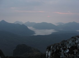
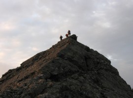
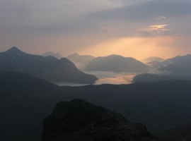
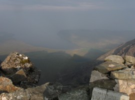
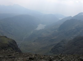
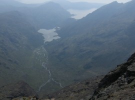
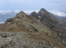
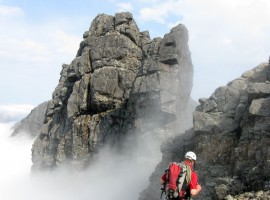
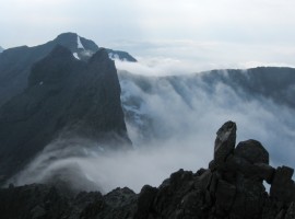
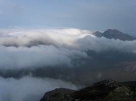
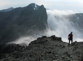
We spent a short while at the summit of Sgurr nan Gillean, enjoying the atmospheric display of cloud streaming over the ridgelines into Coire a’ Bhasteir and having M take a photo of us, before heading back down. As soon as we started descending, the weather conditions suddenly changed, with a chilly air blowing around us to envelop us in cloud. We were shrouded in this misty air almost all the way down to road at Sligachan, which was maybe just as well as it meant I had less to distract me from putting one foot in front of the other to get down and finish walking. It felt like a long couple of hours from where we picked up our packs where we’d deposited them below Sgurr nan Gillean until we got down to Sligachan.

Thanks to our guides’ spot-on knowledge and expertise, good companions, and a big enough weather window, we had a really enjoyable two days traversing the ridge! We will definitely be back!